Roaming About

A Life Less Ordinary

Category: Photography (page 2 of 8)

The Tatacoa Desert – A Unique & Peaceful Ecosystem in Colombia

Despite its famed high temperatures, Mark and I were looking forward to visiting the Tatacoa Desert after leaving Bogota. This off-road adventure promised to bring us peace, beauty, and remoteness. The only problem: our recently punctured and fixed tire. Would it hold up on the bumpy, challenging roads?

(As always, hover over or click on photos in galleries to read their captions.)

Getting to the start of the desert loop was exciting in itself. After a couple of toll roads, road construction delays, another landslide hold-up, a police checkup, a small town, and narrow dirt roads, Thirsty Bella had to cross a narrow, 100-year-old railroad bridge and traverse two windy, one-way tunnels where opposing traffic was not visible. We kept our fingers crossed when entering these dark, water-filled passageways and, once inside, honked and flickered our headlights for good measure. We made it okay! It took us an entire day to drive from Silvania to Tatacoa.

This desert area in Colombia is relatively small, yet, we hoped to stay a handful of days because we craved peace, solitude, and relaxation.

Sign at the beginning of the loop (north side)

Continue reading

Welcome to the Coffee Region in Colombia – Filandia, Salento, and the Majestic Wax Palms of Valle del Cocora

After two chilly nights of camping near Volcano Nevado del Ruiz at 13,000ft (4,000m)), it felt nice to arrive at a lower altitude again. Filandia is located at 6,500ft (2,000m) with pleasant temperatures but Salento and the Cocora Valley had us back at 8,000ft (2,400m) with consistent dreary weather.

Filandia

While Filandia is busy with Colombian visitors over the weekends, it is not so much on the gringo trail. Yet. It’s a cute, colorful, and vibrant town with plenty of places to eat and drink; good coffee being prominent in the local and westernized cafés.

Mark and I parked Thirsty Bella along a quiet street next to the soccer field. Since we were there over the weekend, we were treated to a game. The good thing: we could watch from the comfort of our bed. The bad thing: a plastic horn seller found an enthusiastic crowd buying him out!

Continue reading

A Scenic Highlight in Colombia – Volcano Nevado del Ruiz & Hot Springs (A Photo Blog)

In the middle of March, our trio decided to head south and then east from Jerico, high into the mountains, to visit natural hot springs… The road was long, windy, and not without obstacles, but our biggest disappointment was arriving at our camping spot in the rain, with no visibility.

(Hover over or click on photos in galleries to read their captions.)

But we woke up with this: blue skies and a view of our surroundings.

Imagine our surprise when we spotted this snow-covered volcano on our early morning walk with Maya.

We had to do a double-take!

At 7am and at an elevation of over 13,000 ft (4,000m), it was cold!

The flora was interesting as well.

I was enamored by all the flowers that bloomed at this altitude.

We couldn’t get enough of this view – Can you see Thirsty Bella?

The other side of the valley. Clouds started to roll in again.

After our morning walk and breakfast, we drove to El Sifon hot springs. It wasn’t even 9am yet and the volcano was already covered by clouds, with fog starting to roll in. But the first few miles were still photogenic, with lots of waterfalls along the road.

Where is the trail?

We managed to find a dirt road at some point and descended about 1,000ft towards the river and the natural hot springs.

We had the area to ourselves!

We found our spot: under the two waterfalls was a small pool.

This was a very scenic area, despite the steam.

After our soak – the contrast between the water and air temperature was huge!

One last shot of El Sifon hot springs!

Then, the walk back up was inevitable. It took forever, since the air was thin and we needed to stop often to catch our breath, especially me.

Back at the parking lot, life went on as always.

On our second morning, I encouraged Mark to take a photo of me and my book, Plunge, in front of the volcano…

That’s when we noticed a slight change in the appearance of Nevado del Ruiz…

Most of the snow had melted and it was spewing steam!

The photos underneath were taken around the same time, early in the morning, two days in a row. Do you notice the difference in the volcano’s appearance?

Mark took this fabulous shot.

Mark, Maya, and I came here in our truck camper Thirsty Bella to check out the hot springs and we received these spectacular views as a bonus! It was one of the quietest places we camped in Colombia. We did have to leave after two nights, though, because it was difficult to sleep and breathe at 13,000ft (4,000m) altitude and the condensation inside the camper was so bad that water kept dripping down from the ceiling!

(A week later, people from the surrounding villages had to be evacuated because of the heightened risk of a volcanic eruption and access to this area became restricted. Until now, nothing dangerous has happened. Read a CNN article here.)

360-degree view on our morning walks with Maya

Curious about a previous ten-year chapter in our nomadic lives, which includes eight years aboard a 35-foot sailboat in the tropics with dogs, check out my compelling, inspiring, and refreshingly honest travel memoir:

Plunge – One Woman’s Pursuit of a Life Less Ordinary

Available on Amazon and elsewhere

eBook: US$ 5.99

Paperback: US$ 13.99

Off the Beaten Track Waterfalls, Lakes & Small Towns — Traversing Colombia’s Mountains on Dirt Roads

The negative about writing these blog posts three months after the facts means that I don’t remember all the details. Like when I’m behind with my diary for a few days – which often happens. A positive – in case of the diaries anyway – is that I don’t remember all the details. So, instead of an hour, such an entry takes half an hour to write. 😊

Pretty mountain drive

All this being said, I remember Mark and I wanted to do something different after leaving the sinkholes of Las Gachas: driving to the municipality of Paipa across the mountains, via dirt roads. Why is this such a big deal? Because there is no information available about secondary, or tertiary, routes in Colombia.

(As always, hover over or click on photos in galleries to read their captions.)

A lot of rain falls in this country, causing landslides every day. Our thoroughfare might be blocked by fallen trees, piles of dirt, rocks, or other objects. Or, the road might be gone, crumbled down a cliff. In other cases, the streets might be too narrow or low due to overhanging trees. Our truck camper Thirsty Bella is big. In Colombia it’s not an issue of “When will we get there,” like in other countries, but “Will we be able to get there or do we have to turn around hours into the voyage?” Such is the kind of adventures we embark on these months.

After quickly visiting Guadalupe, filling our fuel tank, backtracking over the narrow, potholed road to the main “highway,” following that south for a couple of hours, and turning off for the rough “shortcut,” we reached Gambita. We descended into this small town, still in the department of Santander, after asking locals if our rig could navigate the narrow streets. It could. Barely.

Continue reading

Spectacular Hike to No Name Lake & Broken Top in Deschutes National Forest, Oregon – A Photo Blog

Mark, Maya, and I spent the last week of August in the Bend, Oregon, area. We visited our friend Patti and her two dogs, Koozie and Pekoe, did a few more projects on our camper, and explored this popular outdoor town and its surroundings.

On a neighborhood walk with the dogs, we could see our destination… that mountain in the distance

We lucked out with permits for the 5-mile No Name Lake & Broken Top trail. The distance was not that long, but the elevation of over 9,000ft made us huff and puff. It was a beautiful day and the views were stupendous. As a matter of fact, this hike competes with the slot canyon one we did in Baja California Sur, Mexico earlier this year for #1 of 2022…

(As always, hover over or click on photos in galleries to read their captions.)

Hiking up

Snow!

No Name Lake

Continue reading

Thursday Doors – In Picturesque, Free-spirited, and Historic Bisbee, Arizona

About a year and a half ago, Mark and I (and our friends Duwan and Greg) visited Bisbee in southeastern Arizona. Other than sightseeing and getting a good feel for this historic town’s vibe, we looked at houses for sale. Yes, there was a time that we might have gotten serious about the prospect of owning a “real” home. But, us being wandering spirits, picky, and frugal made us pass on Bisbee, a town we enjoyed exploring. I blogged about those impressions and experiences here.

(As always, hover over or click on photos in galleries to read their captions.)

It was in this picturesque town that I took a few photos of doors, thinking that, one day, I would join the Thursday Doors blog hop. Yeah, sometimes it takes me a while to follow up on thoughts and ideas. 🙂

Continue reading

Off the Beaten Path in Baja California Sur, Mexico – Cabo Este or the East Cape

While any visit to the Agua Verde area by vehicle can only happen after taking a 30-kilometer/20-mile slow, steep, uncomfortable, and extremely bumpy ride (after another 10 kilometers/7 miles of pavement), exploring the East Cape by its access road Camino Cabo Este is even tougher and more demanding. No wonder this stretch is called one of the worst roads in Baja.

Camino Cabo Este

Luckily, you don’t have to drive the entire 100 kilometers (60 miles) of washboard and potholed dirt track in one go! As a matter of fact, it took us twelve fabulous days to complete this one-way adventure.

(As always, hover over or click on the photos in galleries to read their captions.)

La Paz

But first, Mark, Maya, our friends Duwan and Greg, and I spent a few days in La Paz, where we found a decent parking spot for three nights. Mark and I remember the capital of Baja California Sur as a pleasant town with a good vibe and historic charm. In the last sixteen years, it hasn’t changed much.

Continue reading

Ten Days at a Pebble Beach in Baja – Friends, Wildlife, Hikes, and Views

Our arrival in Baja California, Mexico, was delayed by six weeks, because we decided to work for a month in the Phoenix area (Arizona, USA) after spending more money than anticipated on the cross-country drive from east to west. We also had a few important phone calls requiring unwavering internet and we needed an extra two weeks to prep our camper for the trip.

The majestic Sea of Cortez

Soon after crossing the border in mid-January, we decided Mark should fly back to Massachusetts for a family matter. To accommodate that impromptu trip, we “rushed” south on the peninsula and prepared for his imminent return. Maya and I stayed at a campground in Loreto (Rivera Del Mar) during his ten-day absence.

(As always, hover over or click on the photos to read their captions.)

After all those arrangements and adjustements, you can imagine that we were more than ready and excited to take “a break from life” and start our Baja adventures. On February 1st, we filled our truck camper, T&T, with drinking water, propane, and food, emptied our sewage tanks at the campground, and headed south for a beach vacation along the Sea of Cortez. We spent one night at Juncalito Beach to get a decent start the next morning. The road to our destination in the Agua Verde area would be slow, treacherous, and mind blowing; a perfect introduction to Baja’s roughness and beauty.

As expected, the single-track dirt road contained sharp turns, potholes, small rocks, and gravel. Some parts were steep and nerves of steel were required. Mark did a great job bringing us down to the coastline, where the track turned into the usual Baja secondary road: washboard, sand, and gravel. The cloudy, drizzly weather was unusual.

Continue reading

Extremes in Baja California, Mexico – From Peaceful Paradise to Ferocious Flames

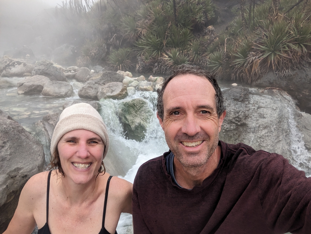
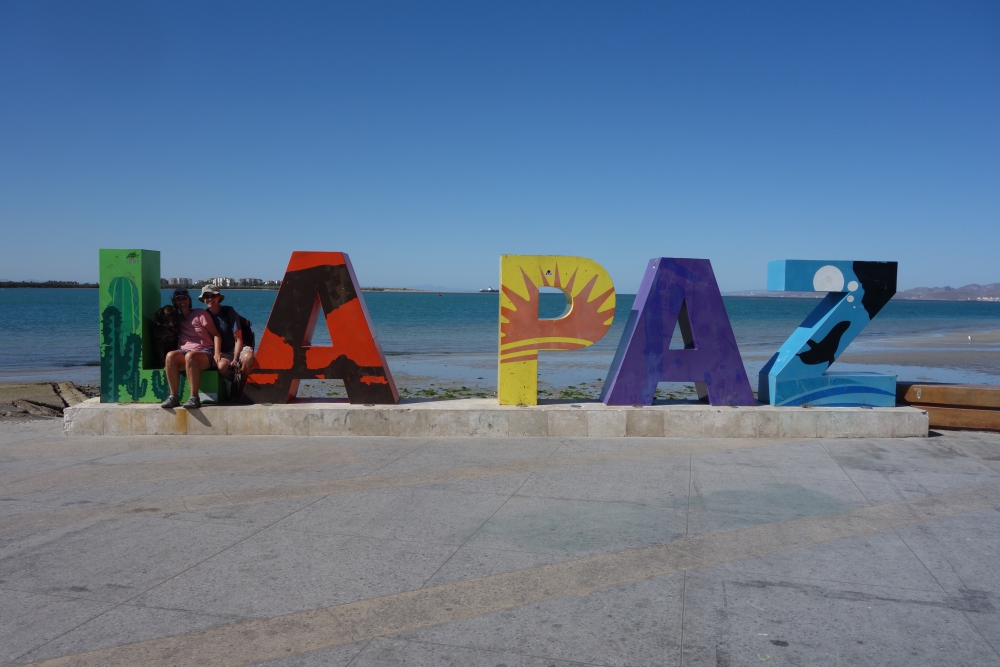
I invite you to come along for a particular 24-hour time period in Mark and my life, last week, in an area south of Todos Santos, on Baja’s west coast.

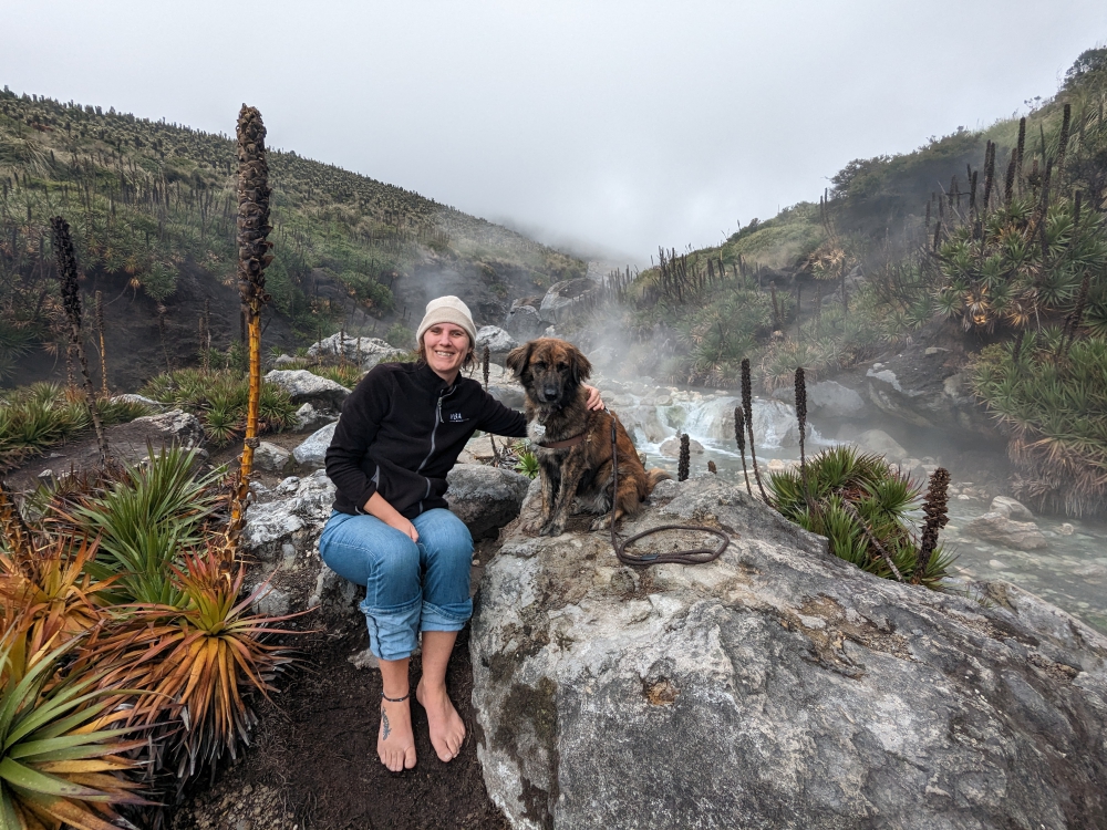
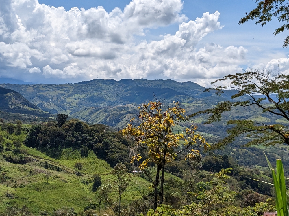
Mark, Maya, and I are driving north along the southwest coast of Baja California in Mexico. We’ve picked a free camping spot for the night at Jimi Beach, which we read about in iOverlander. Tomorrow morning, we will try to access a different place by a waterfall, which promises to be peaceful yet adventurous to reach. That’s why we opt for an early start and not push our luck today.

“I’m not sure camping at Playa Jimi is such a good idea,” I mention as our truck camper T&T (Temp & Thirsty) bridges the gap to our destination’s turnoff on the GPS.

“Why is that?” Mark asks.

“Well, you also read that people were robbed at gunpoint just south of there, two weeks ago. We want to be able to sleep at night and not worry about intruders.”

So far, we have never felt unsafe on the Baja peninsula, but it appears that the southern tip is more crowded, touristy, and potentially dangerous.

“I guess we can go to the waterfall spot instead. Better safe than sorry. It is getting late, though,” Mark says, as he focuses on the road ahead.

We usually aim to be settled by 5pm. It is 4pm and we have no idea what to expect. We change the waypoint on the GPS to the turnoff for this new location. Mark had scrutinized that area on satellite images ahead of time.

“I read the turnoff is very tricky, so look for it carefully. It is situated just past the second bridge,” he says. These “bridges” span arroyos (washes or dry river beds), which are often used as roads.

We slow down and pull over, off the main road. The turnoff is behind us, an extremely sharp bend that double-backs parallel to the highway. The only way to get there is by making a U-turn over four lanes. Luckily, this section of the pavement does not have a divider.

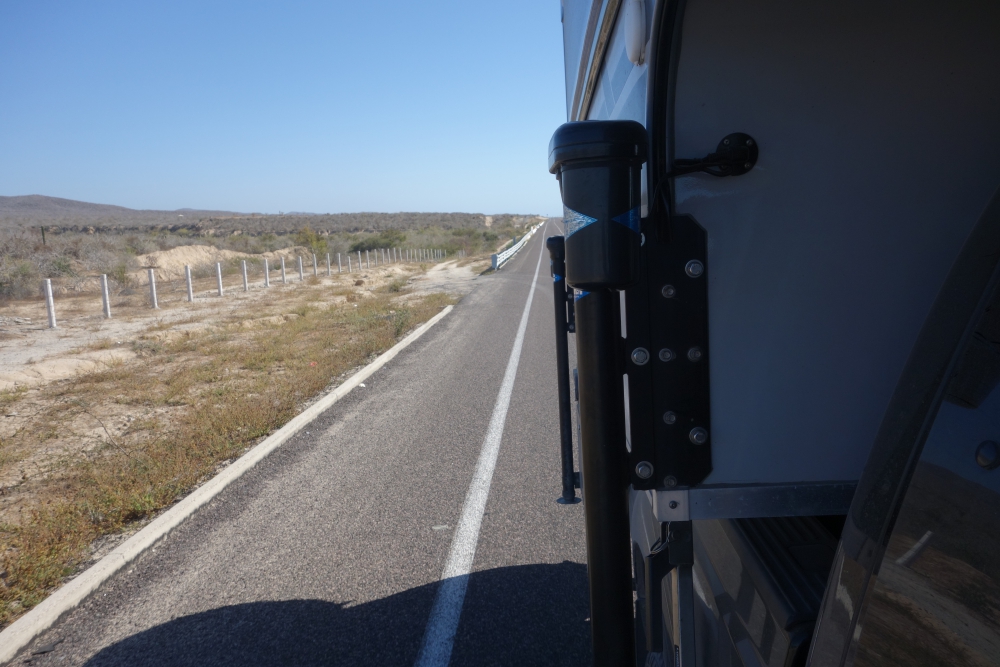
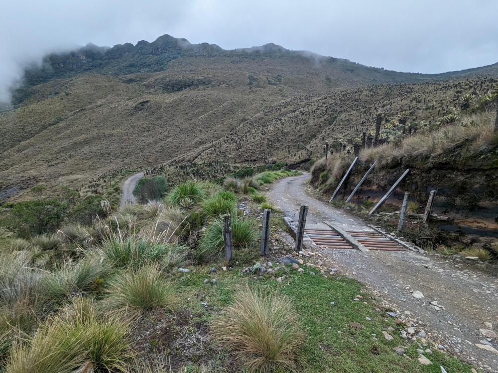
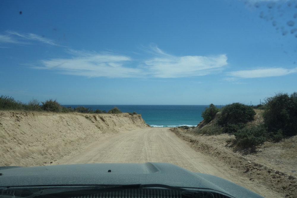
The access road to the fence and arroyo runs parallel to the highway and requires an approach from the north.

We wait until no cars are seen and make a quick loop on the asphalt to reach the dirt road, which leads to a barbed wire fence. I drag it open and close it again after Mark passes. That would keep the riffraff out, we both think.

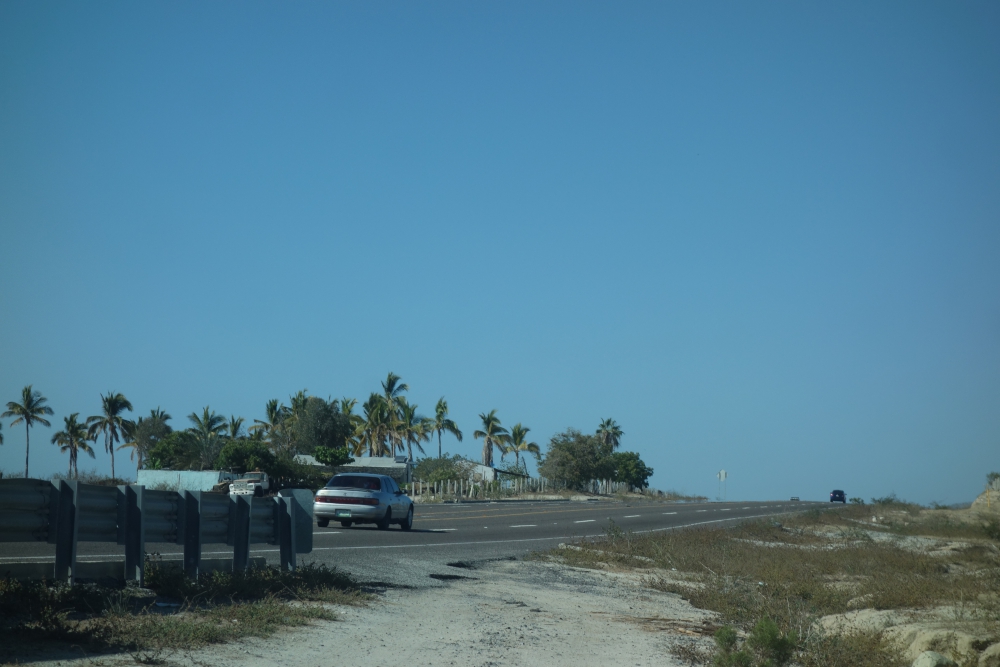
The highway, seen from the dirt road after the turn-off

“Well, that was the worst part,” Mark sighs.

We follow the dirt track and turn left. Based on Google Earth, this is a short and easy stretch to join the wide arroyo Mark had spotted. Except, now, years later, pointy bushes and plants with needles have grown and the access route is very narrow.

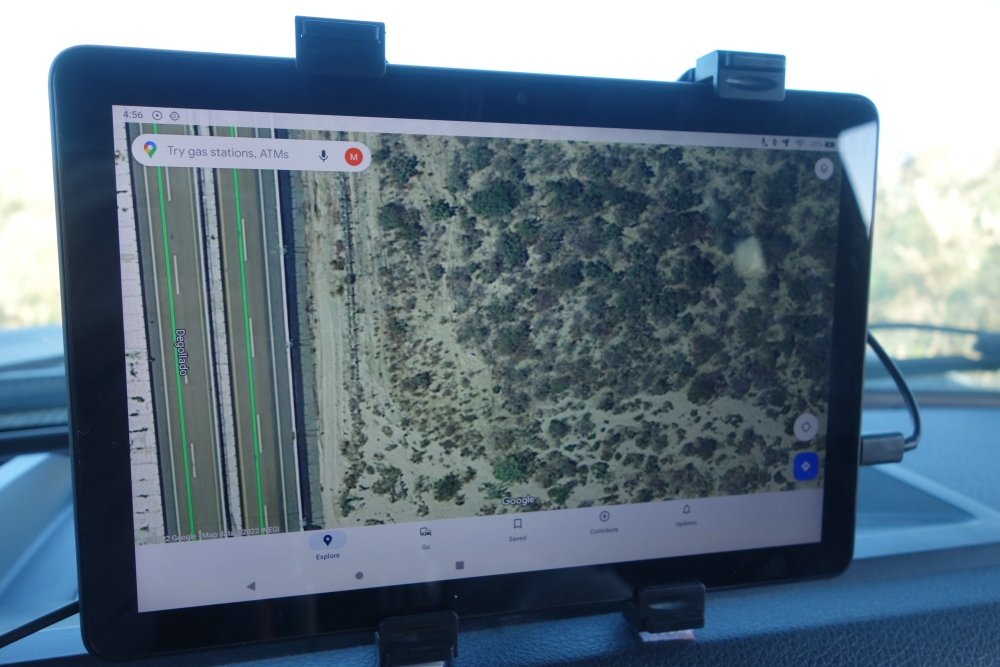
Google Earth image of the area

Not again, I think, remembering our hours of cutting and sawing trees and brush to reach a lovely pebble beach last month. All in an attempt to prevent scratching up our truck camper.

Mark grabs our handsaw, which now lives in the cab of the truck, and jumps out. “You drive, while I cut branches,” he instructs.

For the next forty minutes, he labors and sweats, while I inch our camper forward, trying to avoid the remainder of overhanging branches. There is no room to turn around and we have no idea how much further it is to a less narrow part of “road.”

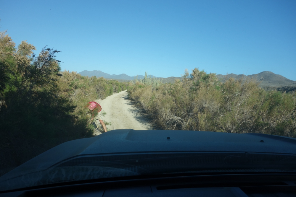
Mark saws branches while I slowly inch the truck forward

The sun is setting fast. Eventually, we reach a wider stretch – we have arrived in the arroyo, where soft gravel and sand await us. Mark takes over the wheel and stops again after a few yards (meters).

Continue reading

Back in Baja (Kind of) – A Week of Dunes, Drives & Decisions

It might not have been obvious in my previous blog posts, but Mark and I were antsy about returning to the Baja California peninsula of Mexico this winter, because we had a great time here last spring, meeting like-minded travelers and taking a welcome break after publishing a book. On this subsequent visit, we hoped to hang out with friends, explore this 1,000-mile narrow stretch of land a bit more, and relax on its many beaches. Our initial goal was to arrive in early December and stay until sometime in April.

Shell Beach vista

After multiple delays – trying to find jobs in Arizona, going to the dentist in Los Algodones, more camper projects in the desert, and a few important phone calls while still in the US with good cell service, we finally crossed the border into Baja on January 12th, six weeks later than planned. It was a good day! We had arrived back in Mexico and we could feel the stress and anxiety leave our bodies. Yet, we realized it would take a while to fully adjust to the life we intend to have: one of plenty adventures with a good balance between work and leisure, and plenty of walks for Maya.

Now that we have a 4WD vehicle (as opposed to our campervan Zesty, last year), more remote campsites are accessible and we feel that’s what a lot of Baja California is about: reaching peace and solitude surrounded by nature and the sea. One thing we noticed from the start, though, is that it’s much busier than last year. We were spoiled in 2021, when rarely a soul crossed into Mexico, and we often camped by ourselves.

Half an hour south of San Felipe is “Shell Beach” along the Sea of Cortez. This was our first stop and an awesome one. Miles and miles of empty beach, low dunes, gorgeous sunrises, clear night skies, and oh-so-quiet.

Continue reading
Older posts Newer posts

© 2024 Roaming About

Theme by Anders NorenUp ↑