Roaming About

A Life Less Ordinary

Category: Places (page 1 of 22)

A Month in Northern Argentina – Dusty Towns, Pretty Vineyards, Wonderful Wine & Scenic Drives

“The scenery is amazing!” “The people are so friendly here!” “Everything just works!” “Argentina is dirt cheap!” – These were the sentiments shared by fellow overlanding friends when they arrived in Argentina, many months before we did. People loved the change of scenery, culture, attitude, and quality of life, once they crossed that “last” border.

Mark and I couldn’t wait to visit. But, sometimes, slow travel bites you in the butt. In March 2024, when the three of us finally arrived in Northern Argentina, prices for everything had doubled, if not tripled or quadrupled, and the excitement of other travelers was lost on us. Because we are on a tight budget? Because we travel with a dog? Because we came from “westernized” Chile with immaculate paved roads, leashed dogs, friendly drivers, clean cities, and modern feel?

In a nutshell: We had expectations when we crossed the border (and that was our mistake, really; we know better than to have expectations). Yet, what we – initially – found were dusty towns, lots of trash, dangerously grooved roads, ear-piercingly loud motorcycles, the smell of burnt garbage, and loose dogs. There were also a lot of indigenous people, unlike in Chile. Northern Argentina felt like an extension of Peru and Bolivia, and it was NOT cheap.

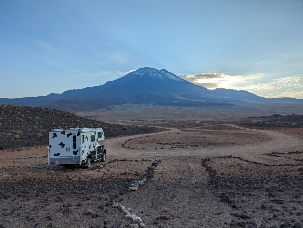
Apart from those experiences as vehicle drivers, long-term travelers, and dog owners, of course there was beauty, joy, and excitement to be found as well. Why else would we still be on the road?

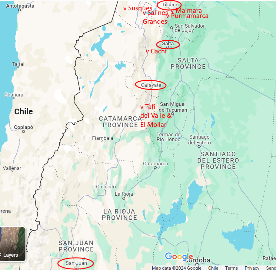
Our destinations in Northern Argentina

Susques

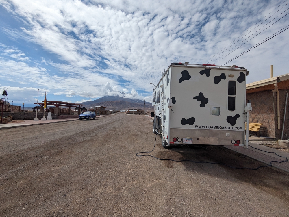
After a beautiful drive, a smooth and efficient border crossing in Pasa Jama, and a disappointing money exchange (our crisp U$100 bills weren’t as crisp as we thought, and the blue dollar “tourist” rate had dropped a lot), we spent our first night near the town of Susques, which has a cute adobe church.

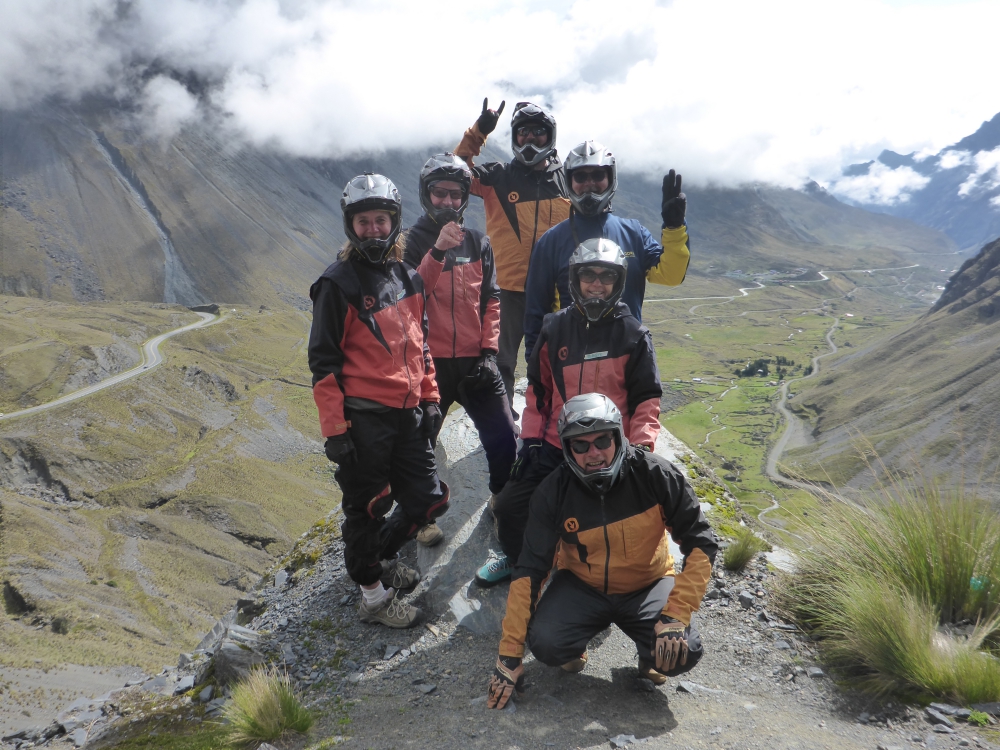
Here, we had to choose between the famously pretty but bumpy Ruta 40 South or the paved comfort of Ruta 68. We picked the easy solution and are happy we did as it delivered beauty in the form of scenery and new friends.

Salinas Grandes

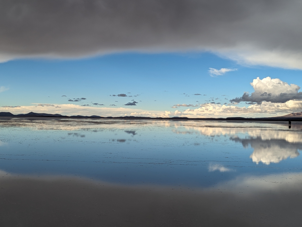
Before reaching our first real tourist town, we stopped at the salt flats of Salinas Grandes. We’d hoped to visit the Ojos, clear pools in the middle of the Salar, on a short van tour, but because of recent rains, this part was too wet to drive on. So, the three of us just walked around the salty terrain with its clear-blue canals – and Maya was a mess!

Purmamarca

In Purmamarca, we only anticipated a hike among the colored mountains. It was a hot afternoon, but the fee for the trail was low and the surroundings bright and attractive. When returning via the center of town, we liked it so much that we decided to spend the night on the sloped parking lot we had pulled into earlier. The pleasant atmosphere of downtown – and the prospect of dinner at a pizza restaurant that didn’t open until 8 pm – had us change plans.

Continue reading

A Day in the Life of a Nomad – Salta, Northern Argentina

Mark and Maya had a restless night. I did a little bit better, staying covered by a sheet. The heat and humidity in Salta are still relentless, this time of the year. It is mid-March 2023. Fall is around the corner in the southern hemisphere, but we had forgotten what it is like to live in a jungle-like setting at barely 4,000ft (1,200m). The day time temperature soars at around 95 degrees Fahrenheit (35°F) and – unlike in the desert or the Andes Mountains – it barely cools off at night. Tiny no-see-um bugs (gnats) make their way through the mosquito screens, so if you leave yourself exposed, you’re itchy as well as sweaty.

We decided to stay at an established campground for a few reasons: it would be quieter than anywhere else in this sizeable city, it is affordable ($5 a night), there are hot showers, toilets, trash cans, and potable water, I had a project with a tight deadline, and the sites are level and shady.

Shady spot at the campground

When we arrived, yesterday, we found a relatively shady spot next to a tree that didn’t obscure our roof-mounted Starlink satellite internet antenna. By this morning, however, our lithium battery is almost drained from being parked in the shade, running all our fans at high speed, and an inefficient fridge that never turned off, because of the heat. Yeah, this is still our expensive, over-priced Isotherm compressor fridge that we bought brand-new in the US, inconveniently replaced in Texas before leaving the continent, and have struggled with since!

Apart from the “validation step,” I finished my translation job, after a sweaty and tough afternoon and evening and – because we are trying to keep our stay to a minimum due to the uncomfortable climate – I have a busy day planned. The idea is to complete all our sightseeing and errands in Salta within one day and head to a higher altitude.

Thirsty Bella in the sun, with laundry strung up

Everything that needs to be done should happen between 8am (when the sun comes up) and 10am (when the heat becomes unbearable). Of course, that is impossible. Because we have unlimited water at the bathroom sinks, I wash our underwear, socks, and shirts by hand. We hang everything up on a line in the sunshine. Then, I prepare for a short visit into the historic center. Mark is not interested in joining – it’s too hot – and stays home with Maya. Ideally, we move the camper in a shady spot, but we need the solar power to charge our battery and our laundry is strung alongside Bella.

Mark and Maya found cooler weather in the shade – the pool is empty now and for ten out of the twelve months

I leave my family by a shady picnic bench and walk to the entrance of the campground, at the opposite end of the grounds. Sweat drips down my face when I inquire about ways to reach town. The public bus stops right in front and is cheap, but you need a card. Colectivos are affordable as well, but they don’t stop by the main square (my destination) and I have no idea where to grab one. A taxi it is. For the first time on this South American trip, the vehicle is metered. Progress is slow and I watch with dread how the meter keeps climbing. When the price reaches the equivalent of $2, I ask the driver to stop and hop out. I’ll walk the last bit.

Continue reading

An Eventful Three Weeks in Northern Chile – As Overlanders

When the three of us left Uyuni, there were two options to exit Bolivia. Initially, like all our overlanding friends, we planned to take the southern route to Argentina, a country everyone raves about. We realized, however, that this meant missing out on Valle de las Rocas and the northern part of Chile.

“At which border will you leave Bolivia?” the vet asked. He needed to know the answer for Maya’s health certificate details. “Ollagüe, Chile,” we said and our fate was sealed.

Ollagüe

The border crossing on February 12th was easy and straightforward. Mark and I had eaten most of our perishables, leaving us with an empty fridge and meager food pantry. We checked out of Bolivia after scanning a QR code, filling out forms, and receiving the exit stamp. There was some confusion, since we each had two entry stamps, due to our border run from Peru, a few months ago.

We received new passport stamps for the new country, obtained a Chilean TIP (Temporary Import Permit) for the vehicle, and handed over Maya’s international health certificate. Another agriculture official entered the camper and – before he started opening cabinets – I asked him which items were prohibited: fresh meats, fish, eggs, honey, and produce. I gave him whatever we had left of one onion and a lime. Then, we chatted about his experiences as a border agent, Afghanistan veteran, and dog owner.

The roads in Chile are amazing!

From the moment we entered Chile, the bumpy, gravel road surface turned into beautiful, smooth asphalt. A joy! We stopped in the town of Ollagüe to find local money and vegetables. We failed on both accounts, but managed to fill our tanks with potable water.

Topping up with potable water in Ollagüe

The volcano route

Another reason we picked this border crossing was the appeal of a scenic drive in the high Andes, past lakes, altiplano (high plains), and volcanoes. Unfortunately, the weather was cloudy and rainy. The views could have been better (where were the anticipated snowy tops?), but we still enjoyed the ride and camping spots and ate whatever we could scamper from the cabinets. There were no stores, banks, or fuel stations along this multiple-day trip. At least we weren’t spending any money.

We could have sped up towards the city of Calama, really not that far away, but we wanted to cherish the surroundings and take our time. Mark, Maya, and I climbed one of the small volcanoes before breakfast one morning. I admit to seriously miscalculating this effort at over 13,000ft (4,000m). I had read this excursion would take 20 minutes up and 15 minutes down. Right. For fit millennials maybe…

Parked between two volcanoes

Continue reading

Two Otherworldly Highlights in Bolivia – Salar de Uyuni & Valle de las Rocas

Salar & Valle de las Rocas in Bolivia

Salar de Uyuni

Salar de Uyuni – or Salar de Tunupa (the local Quechua people prefer to call the area by its original name) – is located 20 minutes north of Uyuni and is the largest salt flat in the world. It measures 12,000 km2, which, to put it in perspective, is a bit over 1/3 the size of Belgium and four times the surface of Luxembourg. For Americans, Rhode Island fits three times into this Salar and Delaware twice – and New Jersey is twice as big.

(As always, click on or hover over photos in galleries to read their captions.)

Many overlanders prefer to drive and camp on this white, vast surface, usually stopping when they can’t see anything but salt around them. A trip on the salt flat with your own vehicle offers a lot of freedom, solitude, and fun, but it also requires protecting the undercarriage from all that destructive salt and giving it a detailed and thorough cleaning in the end. In the dry season. Once the wet season has started in Bolivia, taking your own home on wheels is a bad idea, because the (wet) salt will get anywhere and destroy everything it touches, over time. Plus, some parts of this area are closed when (too) wet.

Reflection pool on the salt flat

With that in mind, Mark, Maya, and I booked a tour for the day. Even better, we arranged a private excursion for our little family to give Maya (who was recovering from a nasty dog bite) enough comfort and space, and to allow us the privacy and freedom of a trip tailored to just the three of us. We could tell our guide wherever we wanted to go on the Salar, what to skip or limit, and whenever we wanted to move on. And, to be honest, at twice the price of a group tour ($120 for the three of us instead of $60), we believed it was worth the splurge. 😊

Our tour started at 10:30am, would finish after sunset, around 8pm, and included lunch and drinks. We decided to skip stop one (the Train Cemetery where we had been living, exploring, and photographing for four days already) and made stop two (salt processing tour and artisanal markets) shorter, for an earlier start on the Salar. A massive rain storm was threatening, so I wanted to stay ahead of that!

Once on the salt flat, the fun could begin! We stopped by the Ojos de Agua, which our Spanish-speaking guide, Eusevio, called the “breath” of the Salar. Water bubbled up from below, as if something was breathing under the surface.

He encouraged us to employ a local guy to take “forced perspective” photos of us and Maya. Since that was affordable, we obliged.

Continue reading

Biking down Death Road in Bolivia – The World’s Most Dangerous Road

Mark, Maya, and I had just started our camp host duties at Las Lomas in La Paz, Bolivia, at the end of December 2023 and our Canadian friends Sheri and Jeff were with us in their truck camper. Jeff and I had done a couple of crazy things in South America so far, like jump off a bridge in Baños, Ecuador, and order patitas from a toothless street vendor in La Paz. If you follow our Roaming About page on Facebook, you might remember that shocking food discovery. If not, I suggest you Google what patitas are. 🙂

So, when Jeff was looking for an adventurous buddy to bike down the World’s Most Dangerous Road, which is located near La Paz, the only thing that kept me from joining was the tour price of around US$70. Then I remembered I still had gift money from my parents. The game was on!

Group shot above a valley

The two of us did a bit of research into tour companies (these daytrips range from $60-$120), picked a middle-of-the-road agency with good reviews (Vertigo), and booked our mountain bike tour for December 29th. There was one problem, however: the company needed at least three participants to set out on Death Road. Luckily, we had a full campground by then and I succeeded in arranging a group of seven people to participate: six bicyclists and one sightseer.

The official name of Death Road is North Yungas Road. Its other famous nickname of The World’s Most Dangerous Road was appointed in 1995 after 200 to 300 people died yearly in accidents, usually from vehicles falling off the steep cliffs. The road is gravel and narrow, single-lane in most places, with barely a guardrail or space to pull over.

Continue reading

One Month in La Paz, Bolivia – As Campground Hosts

The Opportunity

When we first arrived at Las Lomas Campground in La Paz, Bolivia, on Christmas Day, we couldn’t wait to leave. It had been a pain to get here, the nasty approach caused damage to the camper before we arrived, the place was busy and tight, and we had an engine problem.

Soon, however, the cozy environment grew on us. When we learned the owner, Marcos, was leaving on vacation for one month the next day and could use an overlander couple to watch his property and manage the campground, we made a quick decision. We committed to the job. Free camping with amenities in exchange for running this small (and at that moment quiet) business seemed fair – and our trio was more than ready for a break from the road!

(As always, hover over or click on photos in galleries to read their captions.)

The Campground Tasks

The first day we were “on duty,” only our Canadian friends Jeff and Sheri were here. We could get used to this! Being responsible for a small property and a couple of buildings we kept tidy, and sitting outside in the sun, chatting, lying low…

Then, one after another camper showed up and soon, the place was filled to the brim with German and French visitors. Mark and I played Tetris to fit them all onto the property. Someone needed to spend their first night on the street, since there was no more room inside. And, when one vehicle wanted to leave, others had to move around and exit the gate to accommodate the departing campers. That was the scene for a good two weeks, over and after the holidays.

Continue reading

From Cusco, Peru to La Paz, Bolivia – As Overlanders

Peru

Cusco

After my cousin and her husband left Cusco on December 6th, Mark and I finished some work assignments and camper projects (and I created a 2024 calendar for my family), and socialized with our Canadian friends Sheri and Jeff. Just as we were ready to leave town, we learned our American motorcycle friends Katherine and Brandon would arrive the following day!

(As always, click on or hover over photos to read their captions.)

We didn’t want to miss that, of course, and decided to camp on the edge of Cusco for a couple of nights to spend time with them – and work. We have met up with Katherine and Brandon in “every” country of South America so far: Colombia, Ecuador, and Peru. (And, most recently, Bolivia.) After seeing them several times in Baja, Mexico and Idaho and Oregon in the US.

Sheri and Jeff – who we were supposed to meet down the road – had finished their Sacred Valley explorations by then and joined us as well. We had fun times together, especially when Jeff revealed one of his T-shirts… I mentioned in a previous post that our friends had a few surprises for us. 😊

Tinajani Canyon

Us, truck camper overlanders, moved on and drove for two long days. Our first stop – after filling up with propane at the other end of Cusco – was Tinajani Canyon, where we had camped and walked before.

It was quiet at night, but a tad chilly at 13,000ft (around 4,000m). We paid the cheese factory a visit, but they were out of Gouda. This is where the exhaustion and sickness caught up with me, leading to an extra night of staying put, for me to rest. The symptoms reminded me of the flu and I was “out” for five days.

Continue reading

Cusco, the Sacred Valley & Machu Picchu in Peru – With Visitors

Note: For more info and photos of Cusco and the Sacred Valley, which Mark and I visited before, check out this post and this one.

(As always, click on or hover over photos to read their captions.)

Cusco

After our two-week adventure in Arequipa and Colca Canyon, Mark, Maya, and I returned to the tourist mecca of Cusco. We slept the first night for free on the edge of town to walk to the grocery store and stock up, and to have dinner at one of our favorite restaurants, Teryaki.

Shrimp poke bowl at Teryaki

The following morning, the three of us walked to and through the two areas we had booked Airbnbs, to get a feel for them. We stumbled across a “market” along a busy street, where locals were selling puppies. It put a bad taste in our mouths. There are so many stray dogs that need help and a good home, yet, just like in the western world, people would rather buy animals than rescue them.

After our reconnaissance, we relocated higher up, to the Quinta Lala campground, where we met our American friends Heather and Rodney. The idea was to relax for one week, catch up on much needed sleep, and prepare for the visit of my cousin, Griet, and her husband, Wim, on November 20th. Of course, that didn’t happen.

Mark was hired by our friends to install their new Starlink system and did his freelance job other times and I received translation project after translation project, leaving little time for fun and rest. Whenever we had a moment, we enjoyed the company of Heather and Rodney.

Homecooked dinner with Rodney and Heather at Quinta Lala

They had brought parts for us from the US, among which a new laptop, so we focused on fixing and installing a few things in – and on – Bella and getting Mark’s computer ready for use. It was all time consuming.

We also had to make sure Maya received enough exercise, did laundry by hand to save some money, met up with a Canadian friend (tour guide and climber Marie, who surprised us with maple syrup and maple butter), cleaned the interior of the car and camper, and walked into town a couple of times, taking a cab back up the hill. All the while, we needed to consider daily downpours, as the rainy season in Peru had started in earnest.

Continue reading

Arequipa and Colca Canyon – Exploring Southern Peru in a Truck Camper

After our crazy, stressful, and unexpected three-day “border run” to Bolivia, hoping to receive sixty extra days as a tourist in Peru (and eventually succeeding), Mark and I needed a quiet place to recover. Our next destination was Arequipa, but we were not in a rush.

First, we drove the three hours from the Kasani border to Puno, where we stocked up on groceries. Then, we continued for another two hours to a peaceful, remote lake, Laguna Sara Cocha, to rest and catch up on internet chores. Because the elevation was still quite high, at 13,800ft (4,200m), the nights were cold, so we couldn’t linger too long.

Laguna Sara Cocha

When our trio arrived at the lake, we were happy to find a pretty, free camping spot, surrounded by alpacas and llamas. Perfect!

Imagine our surprise, when at 6am the next morning, a Sunday, we woke up to the sound of hundreds of cars driving by. If we wouldn’t know any better, we’d think we were parked next to a gravel highway! We were baffled by the commotion and brainstormed reasons as to why traffic had picked up so much. Did the inhabitants of the little hamlet nearby all go to church – in their own cars – in Puno? Nope. The cars were driving in the opposite direction, towards no-man’s land. A massive party in the middle of nowhere?

When vehicles surrounded Thirsty Bella and people got comfortable on blankets and in chairs near us, I inquired. Apparently, the annual car rally around the lake took place that day and spectators drove in early to pick good “podium seats”! Unbelievable. Our peace and rest would have to wait until the following day.

We embraced this unusual event and reveled in the families having fun on a Sunday morning and afternoon. By the end of the day, only garbage remained.

Laguna de Salinas

Continue reading

Two Highlights in Peru: Pallcoyo Colored Mountains and the Reed Islands of Uros in Titicaca Lake

After we departed the Sacred Valley and Cusco, we had less than two weeks left in Peru, so we headed towards the border with Bolivia, slowly. The idea was to obtain another 60 days or more to meet up with family from Belgium and friends from Canada back in Cusco, the end of November.

Laguna de Huacarpay

Our first night heading east was spent along a small and peaceful lake, enjoyed by local families that Sunday afternoon. The night was relatively quiet, until we were awakened by knocks on the side of the camper at 5am. It was a Peruvian man asking us if anyone else had been camped here in a tent last night. Not that we knew, but why was that important enough to wake up two gringos? We will never know.

Pallcoyo Colored Mountains

Then, we headed to what would become our favorite destination in this country to date. It was a tough one to get to. From the moment we turned off the main road and onto the one-lane side track, we had to back up for three tour vans. We figured in the afternoon, it would be quieter; hence our late start… These were tourists heading back to Cusco at 3pm, after two hours of driving down the mountain.

Luckily, we didn’t encounter anyone else on our way up this narrow, tricky road. After an hour of exercising steel nerves and concentration, we pulled over along the river. Our only company some locals passing by on motorcycles or cars, but mostly a shepherd and her flock of sheep, llamas, and alpacas.

The following day had one purpose: watch the traffic patterns on this tight, gravel road (to use that information for our drive to the top – and back down) and figure out if we would take the camper up or just the truck (leaving our home behind for half a day again). Or, to hitch a ride or pay our way with a tour van, which would mean less flexibility and a bigger crowd.

After deciding to take our entire truck camper up, we left at 6:30am to arrive at Pallcoyo Mountain, also called Three Colored Mountains or Three Rainbow Mountains, an hour later. I was impressed by the scenery along the way. It was as if we were driving through a nature documentary in the Andes Mountains (we were!) – stunning terraces, bucolic scenes like a kid tending to a donkey and a Quechua woman carrying a lamb in a bag on her back that jumped out as we passed, and spectacular yet barren mountain sides at this high elevation.

Continue reading
Older posts

© 2024 Roaming About

Theme by Anders NorenUp ↑