Roaming About

A Life Less Ordinary

Category: Places (page 4 of 22)

A Scenic Highlight in Colombia – Volcano Nevado del Ruiz & Hot Springs (A Photo Blog)

In the middle of March, our trio decided to head south and then east from Jerico, high into the mountains, to visit natural hot springs… The road was long, windy, and not without obstacles, but our biggest disappointment was arriving at our camping spot in the rain, with no visibility.

(Hover over or click on photos in galleries to read their captions.)

But we woke up with this: blue skies and a view of our surroundings.

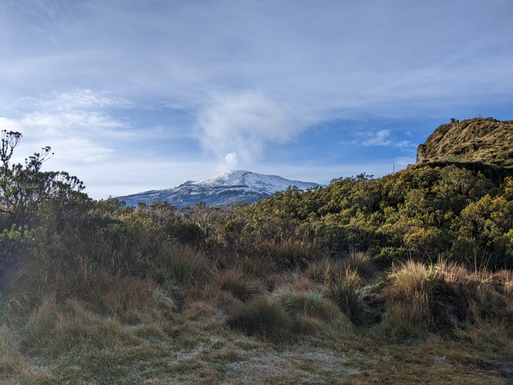
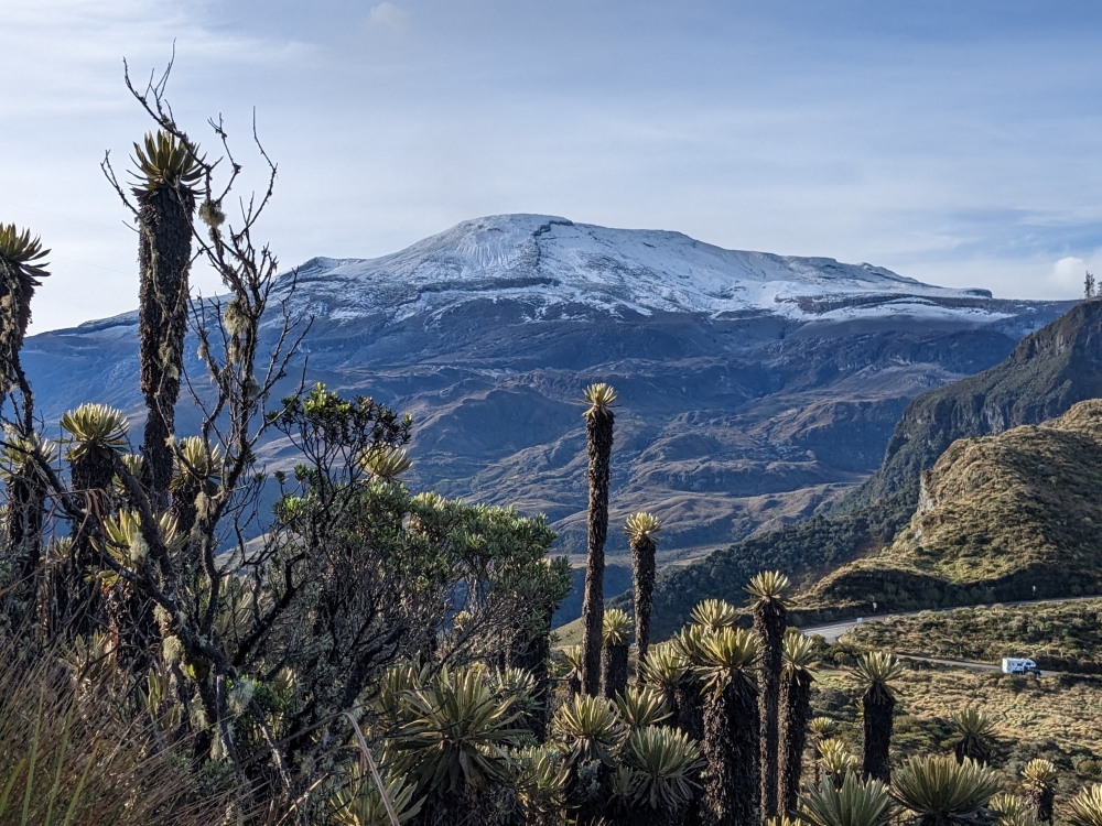
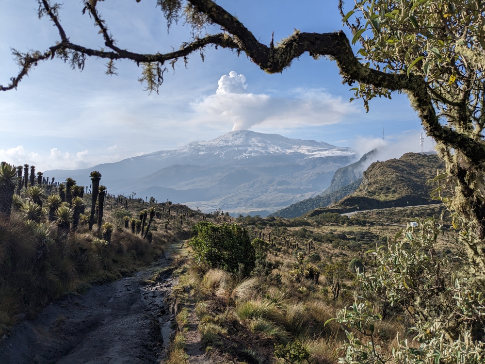
Imagine our surprise when we spotted this snow-covered volcano on our early morning walk with Maya.

We had to do a double-take!

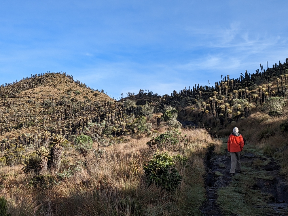
At 7am and at an elevation of over 13,000 ft (4,000m), it was cold!

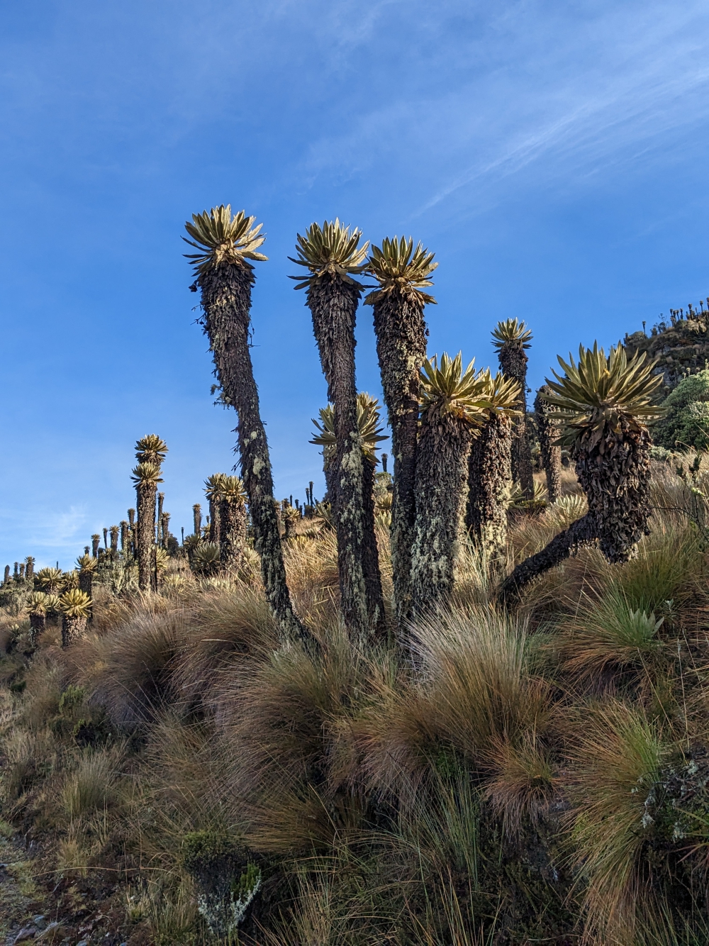
The flora was interesting as well.

I was enamored by all the flowers that bloomed at this altitude.

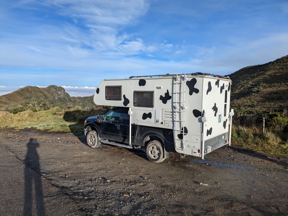
We couldn’t get enough of this view – Can you see Thirsty Bella?

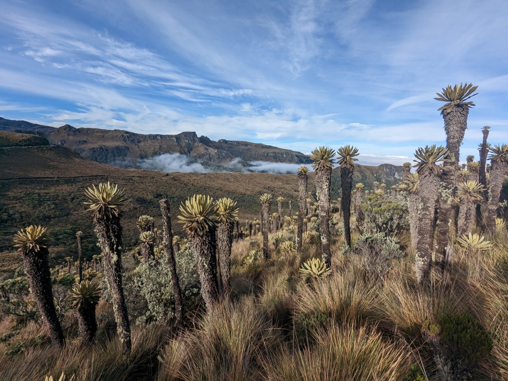
The other side of the valley. Clouds started to roll in again.

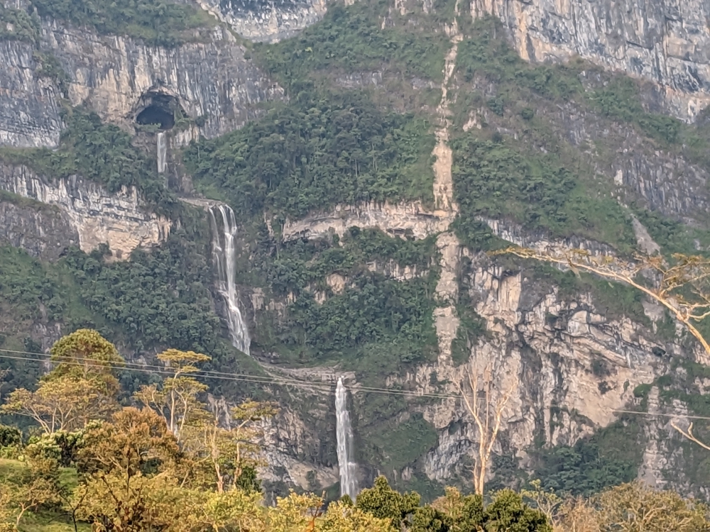
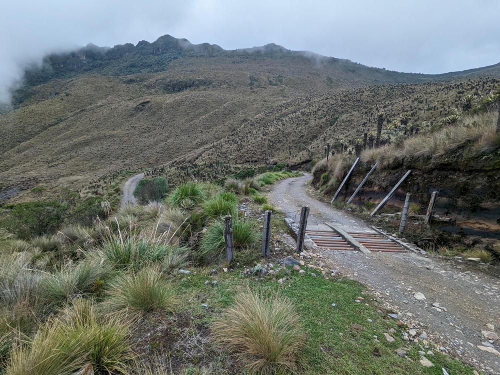
After our morning walk and breakfast, we drove to El Sifon hot springs. It wasn’t even 9am yet and the volcano was already covered by clouds, with fog starting to roll in. But the first few miles were still photogenic, with lots of waterfalls along the road.
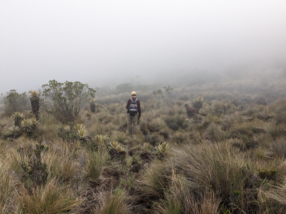
Where is the trail?

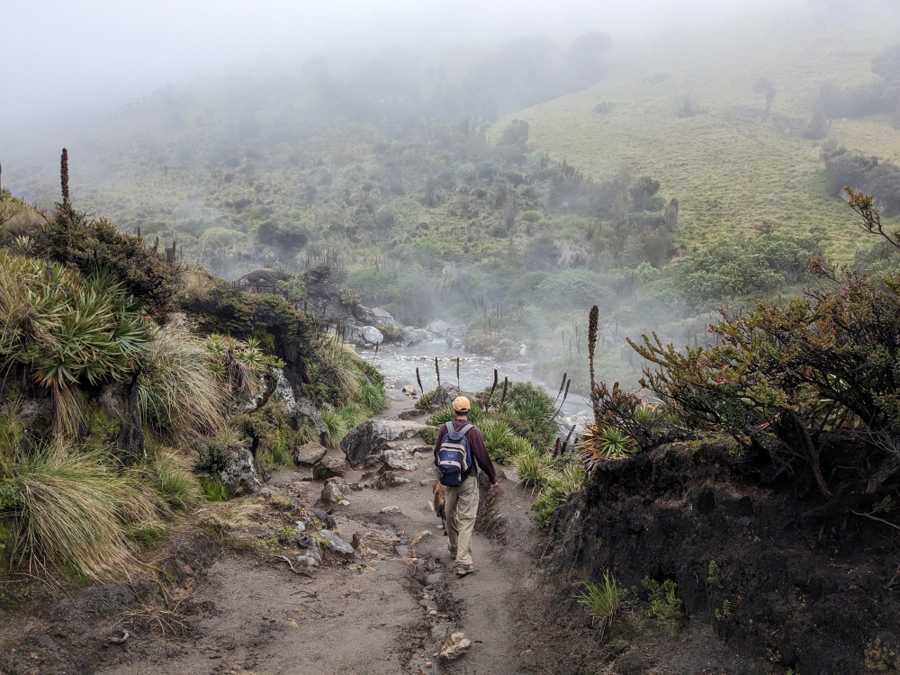
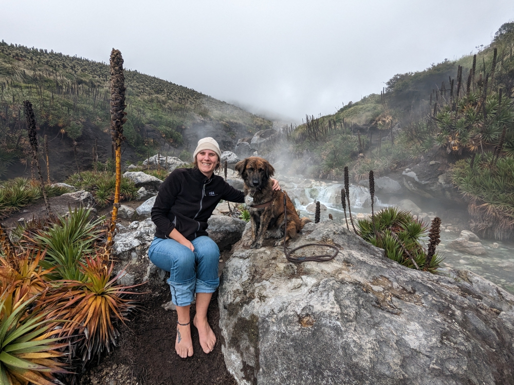
We managed to find a dirt road at some point and descended about 1,000ft towards the river and the natural hot springs.

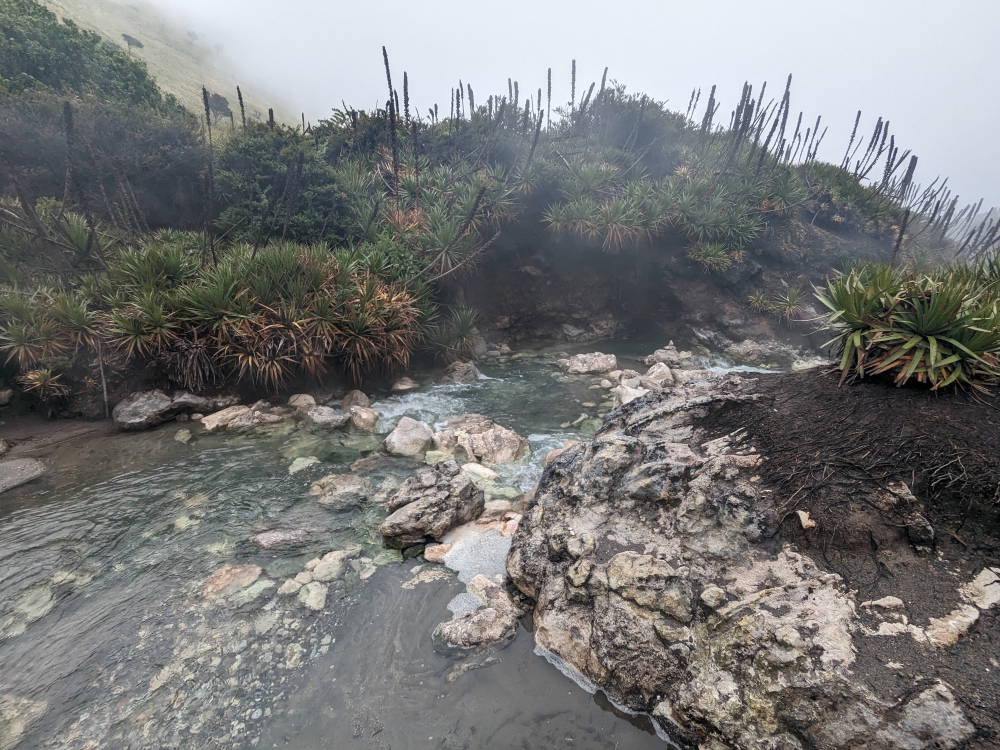
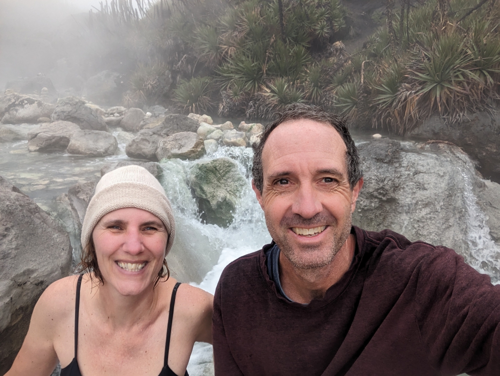
We had the area to ourselves!

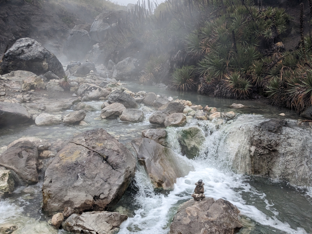
We found our spot: under the two waterfalls was a small pool.

This was a very scenic area, despite the steam.

After our soak – the contrast between the water and air temperature was huge!

One last shot of El Sifon hot springs!

Then, the walk back up was inevitable. It took forever, since the air was thin and we needed to stop often to catch our breath, especially me.

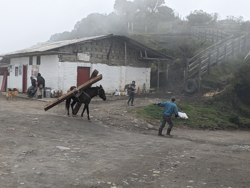
Back at the parking lot, life went on as always.

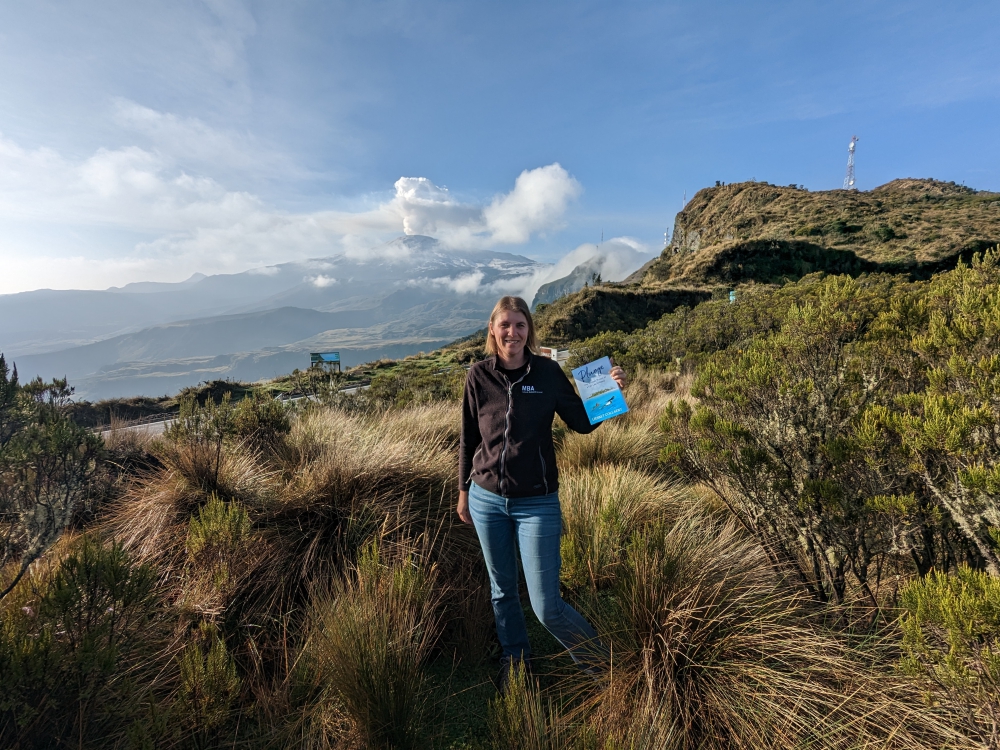
On our second morning, I encouraged Mark to take a photo of me and my book, Plunge, in front of the volcano…

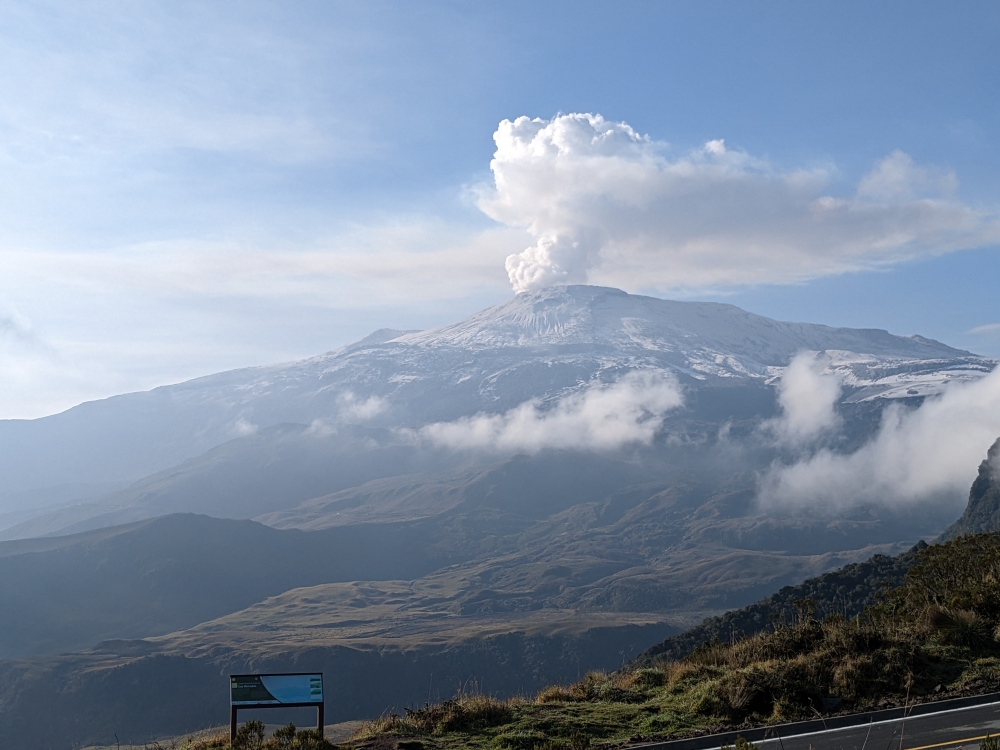
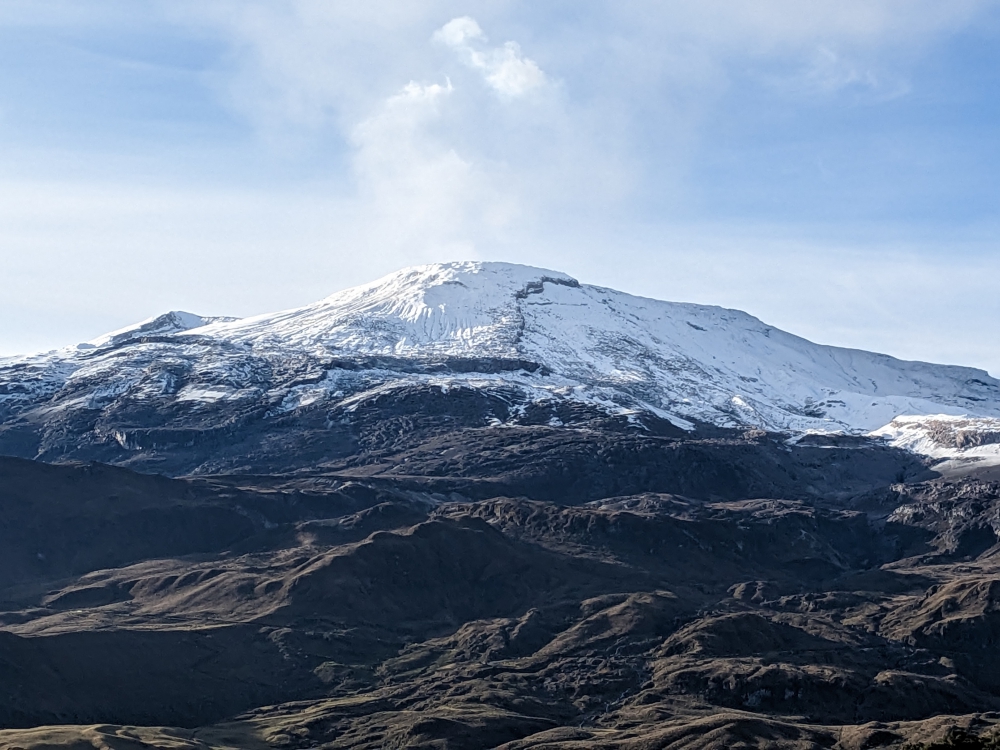
That’s when we noticed a slight change in the appearance of Nevado del Ruiz…

Most of the snow had melted and it was spewing steam!

The photos underneath were taken around the same time, early in the morning, two days in a row. Do you notice the difference in the volcano’s appearance?

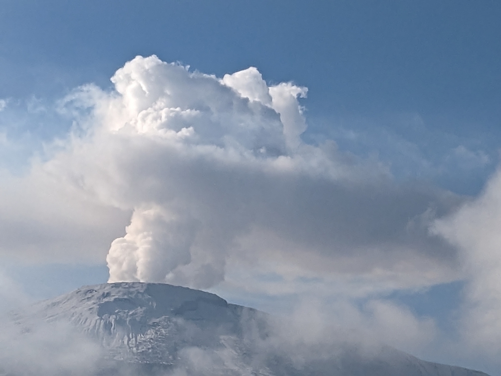
Mark took this fabulous shot.

Mark, Maya, and I came here in our truck camper Thirsty Bella to check out the hot springs and we received these spectacular views as a bonus! It was one of the quietest places we camped in Colombia. We did have to leave after two nights, though, because it was difficult to sleep and breathe at 13,000ft (4,000m) altitude and the condensation inside the camper was so bad that water kept dripping down from the ceiling!

(A week later, people from the surrounding villages had to be evacuated because of the heightened risk of a volcanic eruption and access to this area became restricted. Until now, nothing dangerous has happened. Read a CNN article here.)

360-degree view on our morning walks with Maya

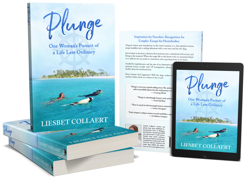
Curious about a previous ten-year chapter in our nomadic lives, which includes eight years aboard a 35-foot sailboat in the tropics with dogs, check out my compelling, inspiring, and refreshingly honest travel memoir:

Plunge – One Woman’s Pursuit of a Life Less Ordinary

Available on Amazon and elsewhere

eBook: US$ 5.99

Paperback: US$ 13.99

A Trio of Quaint Historic Towns in Colombia – Santa Fe de Antioquia, Jericó, and Jardín (Our All-time Favorite)

All three towns have been declared pueblos patrimonios in Colombia (because they stand out for their cultural heritage) and are worth a visit. Medellin is centrally located for attractive day or weekend trips to these destinations in the Department of Antioquia. Or, in our case, for continued travels to explore Colombia. A fourth highlight, Guatapé, sits two hours east and was part of my Medellin post. Santa Fe de Antioquia can be found an hour and a half to the northwest. You reach Jericó after a three-hour southward drive and Jardin is a tad further away, about 3.5 hours to the south.

Historic towns around Medellin

Santa Fe de Antioquia

As a former capital of Colombia and a national monument, Santa Fe de Antioquia is a popular place. It is a beautiful, eye-catching, and photogenic city of 23,000 inhabitants. But there is one problem. For us anyway. Its climate is tropical and humid, due to its low elevation in the Cauca River valley and proximity to the equator. It was in the mid-nineties when we arrived (35°C)!

(As always hover over or click on photos in galleries to read their captions.)

Our first “meeting” with the town didn’t go well. Checking the map for the best route to a free overnight parking spot we had found in our free app iOverlander, we’d picked a one-way road towards our site, thinking it would be wide enough and less littered with haphazardly parked cars. We were right, but… the road went steep uphill and, without any indication, was blocked by road work! We couldn’t go around it. We couldn’t turn around. We couldn’t back up, down this steep and bumpy road without visibility. All the while, motorcycles kept passing us (they could go through) and lined-up cars behind us kept honking.

I enabled a neighbor’s help to open the locked gate of his driveway and guided Mark to safely turn around. We headed back the way we came and my husband was ready to abandon our planned visit. I persisted. We were all sweating (and panting), there was no shade anywhere, and options to camp were limited. On foot, I checked out a parqueadero (parking lot) that abutted the historic center. Big buses and trucks were parked there, so we would fit. We just needed to navigate one more narrow road. Mark obliged and we hid inside our camper, fans on full speed, for the rest of the afternoon.

When the temperature dropped slightly and darkness set in, the three of us quickly walked through the center of town. Unfortunately, the moods didn’t improve. Being kept awake all night by arriving and departing buses, garbage trucks, and dump trucks didn’t help the situation by morning. Mark had had it with this place, so I ventured back into the historic part early and for just one hour. Then, we moved on. Did I mention it was Mark’s birthday?

Continue reading

A Glimpse of Medellin and Its Surroundings – One of Colombia’s Most Popular Destinations

Before experiencing Medellin and environs, we first had to get there – and find places to camp! After our little adventure in Florián, we had a long drive, not so much in miles as in time and bad roads.

“Isn’t Colombia famous for its toll roads,” you ask. I would think so, based on the number of them – and they’re pricey relative to local standards. Yet, nobody talks about them. The main reason I mention toll roads here, however, is because some most of them suck. At least north and east of Medellin. They contain potholes, speed bumps, shifted tarmac, wide cracks, dips, and gaps – and you have the privilege to pay for hitting the obstacles. Hard. Because, you know, the speed limit is all of a sudden much higher on these “highways.”

That is my long-winded way to say that we hit a pothole really, really badly. Neither of us had seen it – I had my eyes on my tablet writing a message (since we were on a smooth toll road, right?) and Mark was staring at the navigation screen to check a potential turn-off.

At the time, we only discovered that the backside of our camper (a structural problem we thought we’d fixed in the US) had become separated again, something we had to fix ASAP. Later, we discovered other issues with the truck as a result of this mistake and the massive impact of the camper and truck bed colliding. From then on, it has been ALL eyes on the road ALL the time…

It took us two days and a loud night along the “highway,” before we reached Rio Claro. We hoped to relax here for a few days, visit a national park, and enjoy swimming in the clear river as – at this low elevation – it was quite hot and humid. We’d quickly stopped at Hacienda Napoles as well, known from Pablo Escobar movies and documentaries. It was closed that day – and expensive, so we’d pass anyway.

We arrived at a recommended campsite along the Rio Claro river around 5pm and took a refreshing swim and cold outdoor shower. Then, I had a translation job. But the cell service was very hit or miss and it took me hours to make little progress.

That night, a huge thunder and lightning storm arrived (which had Maya hiding behind our pillows again). In the morning, the river had turned brown and the internet remained elusive. We drove a few hours to a mirador (viewpoint) in the mountains, where I had to work against the clock to get the assignment finished. Talk about stress. A loud and sleepless night followed.

Our long-anticipated destination

Mark, Maya, and I were excited to finally meet Susan and John in person. It was a long time coming. Expats in Colombia, their lifestyle and travels (in country and abroad) had always intrigued me and I’d been following their blog Latitude Adjustment for many years. When they moved from Medellin to El Retiro a couple of years ago, it all sounded so nice that I wanted to check out their town as well.

Continue reading

Another Off-road Adventure in the Mountains of Colombia — The Waterfalls & Cave of Elusive Florián

After enjoying Villa de Leyva, the end of January, the plan was to embark on another off-the-beaten-track adventure. But, as we wrapped up an extended stay in our favorite Colombian pueblo patrimonio, we faced two possible issues: the weather forecast predicted rain which could make the dirt roads impassable and we were on a deadline, because we wanted to visit our friends Susan and John in El Retiro for a handful of days, before they’d leave on a trip in the middle of February and would have other guests prior to that. Plus, we were in the midst of dealing with a vehicle extension and didn’t know if this would require a last-minute stop in Medellin.

Tiered waterfalls in Florián

Could we fit in a multiple-day side trip to Florián without encountering muddy roads, would the challenging detour be worthwhile, and would we have enough time left to make the two-day drive and visit Rio Claro on the way to El Retiro?

Few Colombians have heard of Florián, located in the middle of the mountains of the Santander department. Wikipedia in English doesn’t have much info but the Spanish page has a bit more data. The town is known for its multi-tiered waterfall, which tumbles out of a cave. It sounded cool but would take us a full day to reach; the last four hours over bouncy, slow, dirt roads.

(As always, hover over or click on photos in galleries to read their captions.)

Mark stumbled across this destination a few months ago, probably seeing photos by a fellow overlander on Facebook. He pinned it in Google maps, which is how we now compile lists of worthwhile destinations. And, by reading in our fat South America Lonely Planet.

When we arrived, exhausted and shaken, we parked along the main square for the night. We walked around town and to a viewpoint of the valley, wondering where the waterfall was located. We surely thought we’d have seen – if not heard – it by now. That’s when we discovered there was nothing but a trickle, none of it visible from a distance. To say we were disappointment is an understatement!

Continue reading

Why We Love Villa de Leyva, Colombia – Camped for a Week in This Picturesque Colonial Village

After a long day on the road with the necessary stress and quarrels, I was in a bad mood when Thirsty Bella rolled into Villa de Leyva, located in the Colombian department of Boyacá. We pulled into a free parking lot, which in my mind would be level, covered in soft grass, and sprinkled with fellow overlanders. I looked forward to finally sitting outside in our camping chairs and having a chat with like-minded travelers, since this town is on the tourist map.

(Click on or hover over photos in galleries to read their captions.)

In reality, it took us a while to get relatively level on our wooden boards, nobody else was there, the green from the photos were poky weeds, and I got eaten alive by nasty no-see-ums in the process of getting settled. Tons of bumpy bites erupted; they would itch for weeks. Never have expectations!

Walking towards town along the tree-lined parking lot

Luckily, once we strolled over the cobblestones and towards the enormous square for the first time, despite wearing flipflops (note to self: sturdy shoes required), we fell in love with this clean, attractive, and historic town. We stayed the entire last week of January, catching up on internet work and exploring Villa and surroundings. The climate was perfect and hiking opportunities abound, but the following are the main reasons for our fondness of this pueblo patrimonio.

Our camping spot

Thanks to our free app iOverlander, we zoomed in on this free parking spot along the edge of town, moving once to get more sun on our solar panels. We had plenty of space around us and as long as we didn’t spend much time outside in this bug-populated field, all was good. We soon learned to constantly wear long clothes and socks and shoes. Against the biting insects and to avoid sprained ankles on the cobblestones.

Our location was perfect to experience this wonderful village and to make us feel like locals. It was a two-minute walk to a dumpster, mere seconds to visit a hairdresser ($6), the main square was situated about five minutes away, as well as a plethora of restaurants, our favorite bakery needed ten minutes to be reached, and we could fill our tanks with spring water for free a couple of blocks away. Donations are encouraged.

When we topped up again before leaving, a parked car caused us to round one corner a tad too wide. The ladder of our camper took some rooftiles down. We stopped, talked to the owners of the gate, and reimbursed them the $20 worth in damage.

The streets

Continue reading

Off the Beaten Track Waterfalls, Lakes & Small Towns — Traversing Colombia’s Mountains on Dirt Roads

The negative about writing these blog posts three months after the facts means that I don’t remember all the details. Like when I’m behind with my diary for a few days – which often happens. A positive – in case of the diaries anyway – is that I don’t remember all the details. So, instead of an hour, such an entry takes half an hour to write. 😊

Pretty mountain drive

All this being said, I remember Mark and I wanted to do something different after leaving the sinkholes of Las Gachas: driving to the municipality of Paipa across the mountains, via dirt roads. Why is this such a big deal? Because there is no information available about secondary, or tertiary, routes in Colombia.

(As always, hover over or click on photos in galleries to read their captions.)

A lot of rain falls in this country, causing landslides every day. Our thoroughfare might be blocked by fallen trees, piles of dirt, rocks, or other objects. Or, the road might be gone, crumbled down a cliff. In other cases, the streets might be too narrow or low due to overhanging trees. Our truck camper Thirsty Bella is big. In Colombia it’s not an issue of “When will we get there,” like in other countries, but “Will we be able to get there or do we have to turn around hours into the voyage?” Such is the kind of adventures we embark on these months.

After quickly visiting Guadalupe, filling our fuel tank, backtracking over the narrow, potholed road to the main “highway,” following that south for a couple of hours, and turning off for the rough “shortcut,” we reached Gambita. We descended into this small town, still in the department of Santander, after asking locals if our rig could navigate the narrow streets. It could. Barely.

Continue reading

Introduction to the New Year and the Colombian Mountains — Historic Barichara, Guane, Guadalupe & Las Gachas

On New Year’s Eve, after exploring a few lesser-known towns and sights, Mark, Maya, and I arrived at campground Guiamaro to spend the New Year period with our friends Sheri and Jeff from Canada. But first, we had to navigate the narrow streets of historic Barichara, another one of Colombia’s 17 pueblos partrimonios, which stand out for their cultural heritage.

Driving into Barichara

While small for the US, Thirsty Bella is gigantic for Colombia’s town centers!

The area around Barichara, in the department of Santander, offers different places to camp in a peaceful environment, but we picked this official camping for its location – away from any settlement and along hiking trails to the center of town and another village called Guane – and its facilities; hot outdoor showers, a communal kitchen, and a washing machine. Of course, our ulterior motive was to escape any NYE fireworks for our stressed-out dog.

(As always, hover over or click on photos in galleries to read their captions.)

Continue reading

Finishing the Year 2022 in Colombian Small Towns and Nature – Off the Beaten Track in the Department of Santander

After our experience in Gramalote over Christmas, Mark, Maya, and I left the department of Norte de Santander and found more touristy areas in Santander; popular destinations for Colombians. We hadn’t seen and still didn’t see gringos for weeks. This made it special for us to meet curious locals and to practice our limited Spanish. Few Colombians speak English.

We split ways with our friends Sheri and Jeff for a few days, as we looked forward to reaching a couple off-the-beaten track places. The less busy, the less fireworks! Our first objective was Chicamocha Canyon and its town along the river, Cepitá. The more you descend in the mountains, the hotter it gets, so we decided to stop for the night at an area near the top of the ravine.

(As always, hover over or click on photos in galleries to read their captions.)

A bit more on edge since the incident in Gramalote Viejo, we both needed to feel comfortable boondocking (wild camping). Being right off the road meant we were visible for passersby, so we decided to only camp here for one night. The view over the canyon was spectacular and we were visited by goats.

Continue reading

Our Colombian Christmas Story – From Horror to Hospitality

DISCLAIMER: This is a real-life story, nothing more, nothing less. Just like when sharing a previous, relatively scary experience about a car burning out next to us in a remote area of the Baja Peninsula, Mexico, a year ago, I’m not looking for sympathy, concerns, warnings, or criticism. Also, like the previous story, this one has a good ending. Bad things happen everywhere. We are aware of that and realistic about it. In the twenty years of being nomads, this was the very first time we felt unsafe. And we do not blame it on Colombia or its people.

(As always, hover over or click on photos in galleries to read their captions.)

The Setting: Gramalote Viejo, Norte de Santander

After spending about a week in Playa de Belen in the department of Norte de Santander, Mark, Maya, and I drove many hours into the mountains, up and over terrible roads consisting of rocks, gravel, bumps, and potholes to reach Gramalote Viejo in time for Christmas. Our friends Sheri and Jeff had already arrived in their truck camper. They drive faster and had less errands to run. 

We parked by the spooky remains of a church, on cracked pavement with weeds poking through. Next to us sat the ruins of a town square and a dilapidated gazebo we repurposed as our happy hour patio.

A peek behind the slanted, still existing church façade revealed old crypts with human bones, most of the cubby holes plundered. Vegetation had taken over the church property and an eerie atmosphere lingered. 

Continue reading

The Start of Our South America Adventure in a Truck Camper – Inland to Mompox & Playa de Belen, Two Colonial Towns in Colombia

Colombia is expansive and diverse, as we would soon learn. It is the 25th largest nation and has the third-highest level of biodiversity in the world, after Brazil and Indonesia. The country is bigger than Spain and France (or Texas and California) combined. While it had a bad reputation for many decades due to drug trafficking and guerilla activity, especially during the eighties and nineties, it is now regarded as one of the safest countries in Latin America.

A thread you will notice throughout my upcoming blogs – and photos – about Colombia is that the people are incredibly welcoming, curious, and friendly, especially on the off-the-beaten-path and that the roads and drivers are incredibly awful; an interesting juxtaposition regarding human behavior!

(As always, hover over or click on the photos in galleries to read their captions.)

I will take the opportunity to introduce a potentially new term to you here: “overlanders.” These are the people who explore countries and continents – even the entire world – overland, meaning by camper; truck campers like ours, vans which are the most popular means, jeeps with a roof tent, and real expedition vehicles, as in old, built-out fire or army trucks. We have also seen Class C motorhomes; a bit inappropriate as they are long, wide, and low to the ground. The act is “overlanding”. 🙂 Just like in North America, our main resource to find (free) camping is iOverlander.

Cartagena – Mompox – Playa de Belen

Mompox (Bolivar Department)

After being stuck in hot and humid Cartagena for five weeks, waiting for Thirsty Bella to finally show up and blowing our budget on Airbnbs without having much fun, we wanted to leave the coast ASAP. We’d need a few days to straighten our home and life out, but most of that would have to wait until we found a cooler, more comfortable climate in the mountains. Once Bella was safely in our hands, we spent a total of five hours on getting ready for the road, filled with propane and fuel, and left the massive city.

Some overlanders meander north from Cartagena, others head south, few drive east (or southeast), and a handful rush through this country with Medellin as their next destination and Ecuador a week or two later. Why go through the hassle, money, effort, and patience for a meager six-month South American whirlwind?

Mark and I were granted three months in Colombia upon entering the country with an option to extend this allowance with the same amount of time. Since we already “lost” five weeks before we even started this adventure, we would apply (and eventually receive) this extension – for the two of us and our camper – in January/February.

Mid-December 2022, Mark, Maya, and I decided to head southeast to the heritage town of Mompox (also called Santa Cruz de Mompox or spelled Mompos), which took us two tough and hot days to reach, mostly over slow and potholed roads. Because Mompox is located in the Magdalena River valley, it was even hotter and muggier than Cartagena and we decided to spend our one night there in a cheap hotel ($10/night). Finding one that we could reach – and park at – with our big vehicle was a challenge.

Continue reading
Older posts Newer posts

© 2024 Roaming About

Theme by Anders NorenUp ↑