Peru has been a struggle for Mark, Maya, and me, but we hope to find our groove one of these days. Not that anything bad happened. Just that things have been difficult – finding internet, being able to sleep at night due to noise, witnessing all the trash, not connecting with the locals, weird vibes, the bad quality of food in stores, the higher cost of living – and fuel…
Jaen
The border crossing from Ecuador into Northern Peru in La Balsa was busier than usual on a Sunday, but everything went relatively smoothly and was wrapped up within two hours. As always, the TIP (Temporary Import Permit) for the vehicle took the longest to obtain. Our biggest disappointment happened at immigration. Mark and I requested a “visa” for six months, but the officer was only able/allowed/willing to give us three. Peru is a huge country to explore within three months by camper.
At the Peruvian land border
Waiting in line to get access into the country
Bye, bye Ecuador
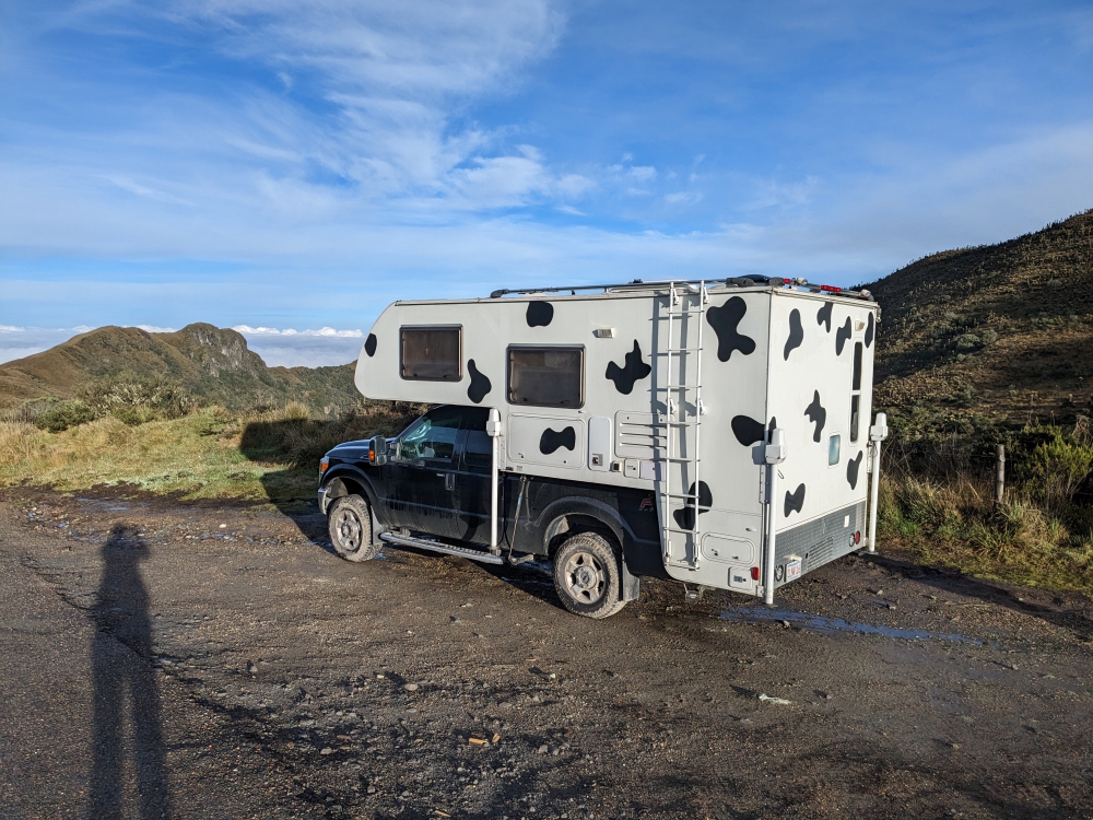
From the moment we touched Peruvian soil, the roads turned into smooth pavement and offered a welcome change. People were drying coffee beans alongside, which cut the width of usable surface in half, but traffic was light. We took in the sights and pushed all the way to Jaen, the first city. We found a decent-looking camping spot by a river and needed the local currency (soles), a Peruvian SIM card and data plan for internet, and food.
Plenty of space in between, as long as nobody comes from the other side…
Drying coffee beans
We were surprised to see rice paddies, but the border was at a low elevation with a temperature of 90 degrees F.
After Mark, Maya, and I finished our car projects and left the comfortable and safe haven of friend Graham’s driveway in Ibarra, we only had four weeks left to explore the central and southern part of Ecuador, before our three-month visas expired. We hadn’t gotten very far yet, after two months!
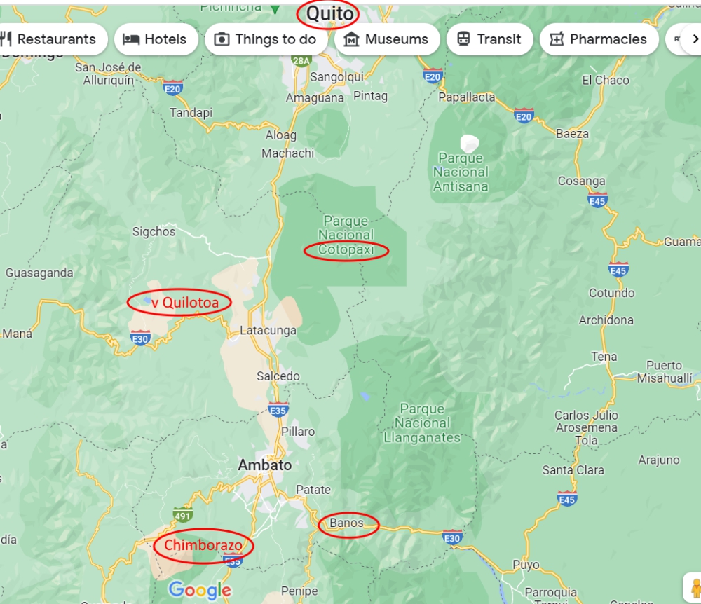
Our visited sites in Central Ecuador
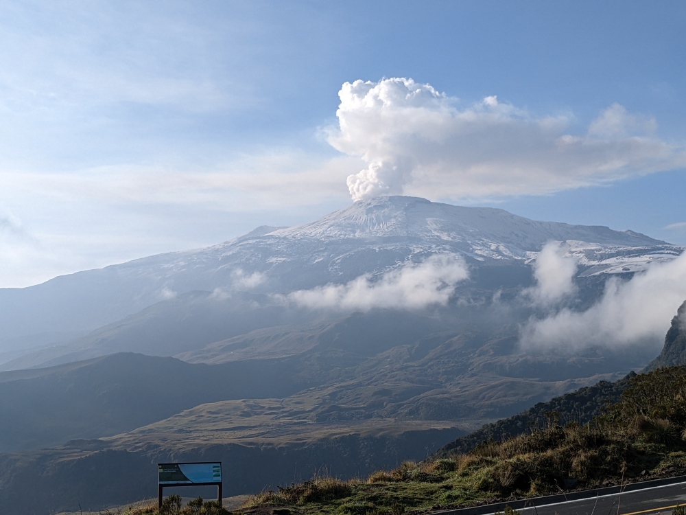
Cotopaxi Volcano
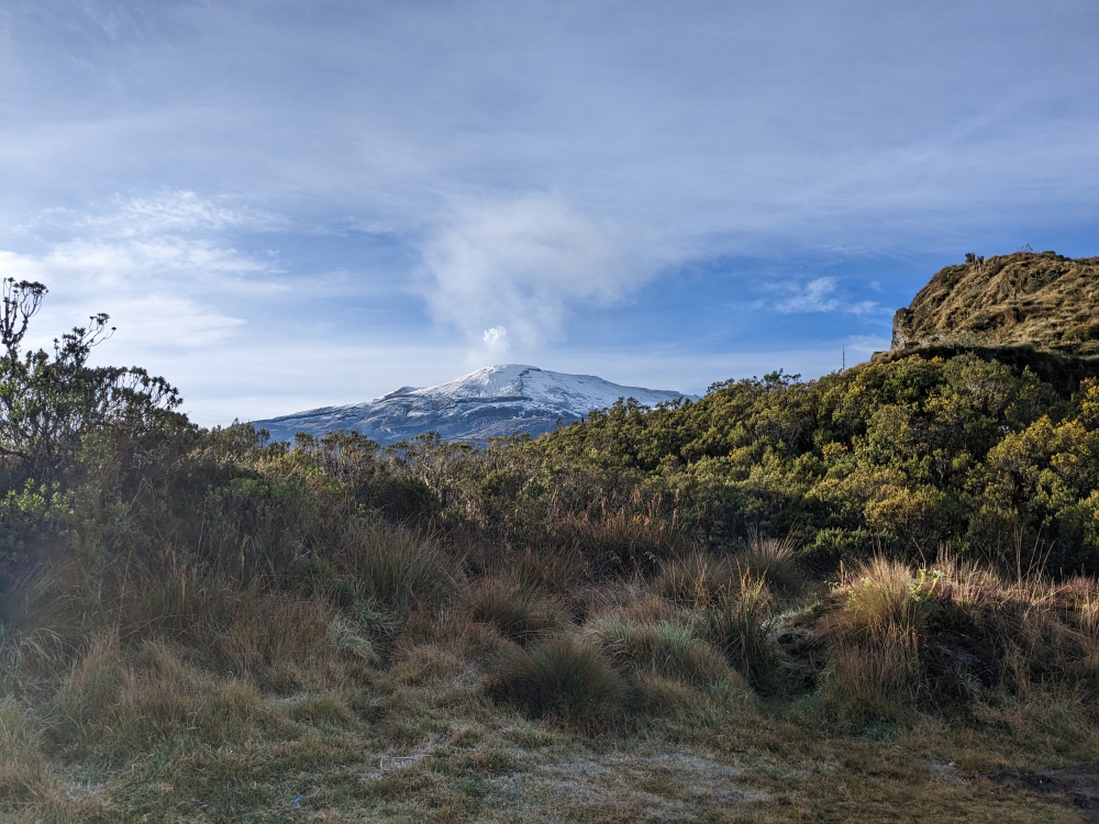
We drove a bunch to pick up our trail from a month prior, south of Quito, the country’s capital. Our first stop was the impressive Cotopaxi volcano, which is often hiding in the frequent clouds at this altitude.
Cloudy arrival at our camp spot
Thanks to our free iOverlander app, we found a peaceful wild camping spot near the national park. We failed to see the mountain, but we persevered, spending two nights at 12,000ft (3,650m) without internet, walking Maya in the paramo, meeting wild horses, running our heater at night, and waiting for a glimpse.
Pretty horse
More wild horses
Morning walk with Maya
Small waterfall during our explorations
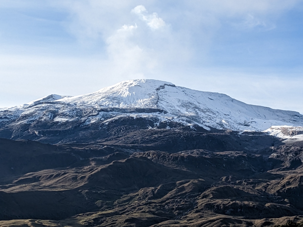
On our second evening, after the sun set, we spotted Cotopaxi’s snowy top. The light was not ideal for optimal viewing or photography. We crossed our fingers for a clear morning the following day as, unfortunately, we couldn’t stay longer due to the lack of cell service.
Waiting for a glimpse of Cotopaxi’s top
The volcano appeared in the last light of the day.
And, look what we woke up to on day three! Time for photo shoots – and to drive into the national park for an up-close view and feel of Cotopaxi!
Early morning glimpse of Cotopaxi
A joyful walk
The moment to take selfies
The same small waterfall, now with the volcano in the background
Another family portrait attempt
Since dogs are technically not allowed in Ecuadorian national parks (which are free), Maya stayed in the car and camper during our visit. We first drove to a small lake with decent views.
National Park entrance
Hand-drawn map of the park
Driving into the National Park
Getting closer to the active volcano
Not too much snow left
A detour to the lake
A mellow day
Then, our heavy vehicle managed to climb the volcano itself, to the parking lot at 15,000ft (4,570m), from where visitors can ascend the mountain to a glacier and refugio (shelter/restaurant). It is possible to climb further to the top with a guide. As you can imagine, the air was thin here and putting one foot in front of the other laborious. Mark made it “up there,” but I had to turn around when dizziness and a serious headache threatened.
Slowly climbing to 15,000ft with Thirsty Bella
Approaching the road up Cotopaxi
Ready to ascend the mountain on foot to the “refugio” (building up ahead)
View from the climb up, before I turned around
When we drove back down the volcano around 11am, it was already shrouded in clouds again.
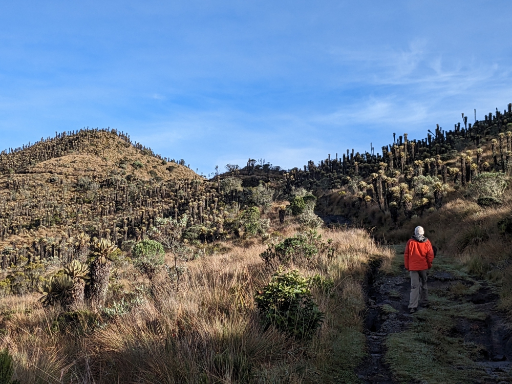
Quilotoa Lagoon
Quilotoa has been a highlight for many visitors to Ecuador, so we had to check it out. The road to the small town with the same name was paved and pretty, but realizing that hundreds of homeless, starving dogs are being dumped and now linger along this “highway” was heart-breaking.
Stray dog in the gutter
Waiting for food
I really hope someone picks a dog up once in a while
After our time in Quito, Mark, Maya, and I had less than a week left, before Mark would fly out of Ecuador for seventeen days.
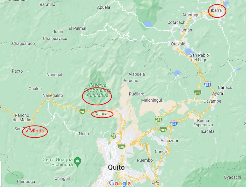
June stops in Northern Ecuador
We contemplated traveling to Amazonia/El Oriente, the jungle in the eastern part of the country, but soon realized we’d need more time for that massive detour and unique experience. So, we headed west, to Mindo.
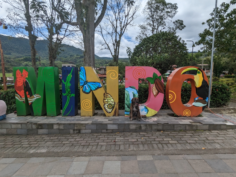
Mindo
Mindo is a popular destination for travelers alike, especially backpackers and families. While the town is nothing special, activities in nature abound. From tubing to hiking; from cable cart riding to ziplining. We found a decent place to camp for free near the center of town, which allowed us to splurge at some of the western-style restaurants.
We also moved to a riverside spot for one night, to be able to sleep better, but since there was no cell signal, we couldn’t stay long.
This school group decided to pose in front of Thirsty Bella for their photo.
Our camping spot was a popular place to launch tubing adventures from.
Our main reason to come this way was a hike in the jungle among a plethora of waterfalls. Mindo is at a much lower elevation than we have been used to in Ecuador. At only 4,000ft (1,200m) above sea level, the climate turned hot and humid, yet still very rainy. It’s the perfect place to grow mold and we can’t quite see the attraction of living there. Is that why so many properties are for sale?
In tourist towns, everything is more expensive. The usual way to reach the park with the waterfalls is via two cable carts, in which Maya was allowed. The lower one was pricey; the second one was included in the waterfall trail walking fee of $5 a person. Since the entrance to the park is quite the hike up and our camper couldn’t fit over the bridge to get there, we paid for a single cab ride.
On May 4th (an easy one to remember), Mark, Maya, and I crossed the border from Colombia into Ecuador; a non-event that took about two hours and was much more relaxed than any Central American crossing we remember from 2006. Our visa stamp allows us to stay for 90 days.
Welcome to Ecuador!
Getting our entry stamp was easy and fast; the temporary car importation paperwork took about an hour to retrieve.
Northern Ecuador Sights
Tulcán
Our first stop – after shopping for groceries and being pleasantly surprised to see dumpsters everywhere – was the topiary garden of the Tulcán cemetery. That first day in Ecuador, we also managed to get a SIM card and buy data and non-sweet bread, before settling at a great little spot by a pond.
(As always, click on or hover over photos in galleries to read their captions.)
Our first stop in Ecuador
Cool designs
It was a joy to walk around in the garden
The garden had a lot of alleyways
Enjoying the “plant statues”
San Gabriel
Laguna El Salado
If you’ve been reading my previous blog posts, it won’t come as a surprise that Colombia wore us out. Despite being enamored by its cute towns, beautiful scenery, and extremely friendly (and curious) people, the country is still rough around the edges and quite busy and loud. So when we stumbled across our first free boondocking (wild camping) spot and discovered it was quiet and attractive, we stayed for almost a week, catching up on sleep, work, and walks with Maya.
Camped by Laguna El Salado, which does not have salt water
Nice weather and quiet days
In Ecuador, people are curious to learn more about our lifestyle as well.
El Centro
Coming from Colombia, which has heaps of colorful, historic pueblos (towns), we knew not to expect much architectural eye candy in Ecuador. The center of San Gabriel was alright – tiendas (stores) and panaderias (bakeries) abound – and we learned that prime street parking spots (marked with blue lines) come with a fee.
The center of San Gabriel
Main plaza
Colorful church in the city center
Cascada de Paluz
Some locals had told us about this off-the-beaten-track waterfall, so we decided to check it out. After following a potholed dirt road for fifteen minutes, we reached this well-maintained and pretty park. The waterfall was impressive and overlooked by elves!
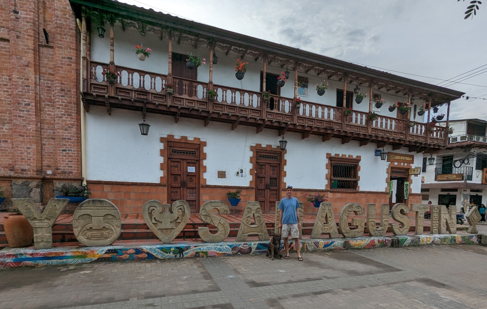
San Agustin in Southern Colombia seems to be on the list of every visitor. We marked it way back as a top destination as well as another archeological site in Tierradentro, but gave up on the second, “underground” part when hearing reports of recent criminal activity in that region.
San Agustin in Colombia
Location San Agustin
We reached San Agustin in the middle of April, after a two-day drive from the Tatacoa Desert.
(Click on or hover over photos in galleries to read their captions.)
Beautiful view of the Magdalena River along the way to San Agustin
We’ve often driven through rows of trees like this in Colombia
Snacks I bought from vendors on these long rides – tiny grapes and two kinds of nuts. The “cheese sticks” were a gift from a Colombian family also waiting in line for another landslide cleanup.
The town itself doesn’t have much to offer. We might be spoiled with all the cute and colorful pueblos we encountered north of here.
It was still nice to walk to town from our free camping spot, shop for produce at the market or Ara grocery store, go out for a couple of meals, and watch the scene from a park bench. The main reason we spent a handful of days here was to do online work.
After two chilly nights of camping near Volcano Nevado del Ruiz at 13,000ft (4,000m)), it felt nice to arrive at a lower altitude again. Filandia is located at 6,500ft (2,000m) with pleasant temperatures but Salento and the Cocora Valley had us back at 8,000ft (2,400m) with consistent dreary weather.
Coffee Region in Colombia
Coffee Region, Colombia
Filandia
While Filandia is busy with Colombian visitors over the weekends, it is not so much on the gringo trail. Yet. It’s a cute, colorful, and vibrant town with plenty of places to eat and drink; good coffee being prominent in the local and westernized cafés.
The weekends are much busier than the weekdays
Mark and I parked Thirsty Bella along a quiet street next to the soccer field. Since we were there over the weekend, we were treated to a game. The good thing: we could watch from the comfort of our bed. The bad thing: a plastic horn seller found an enthusiastic crowd buying him out!
In the middle of March, our trio decided to head south and then east from Jerico, high into the mountains, to visit natural hot springs… The road was long, windy, and not without obstacles, but our biggest disappointment was arriving at our camping spot in the rain, with no visibility.
(Hover over or click on photos in galleries to read their captions.)
A windy road climbing up, up, up
As often, mountain roads in Colombia aren’t great…
Lots of construction areas
Delays and cleared-up landslides
And, where there are mountains, there is rain!
But we woke up with this: blue skies and a view of our surroundings.
Imagine our surprise when we spotted this snow-covered volcano on our early morning walk with Maya.
We had to do a double-take!
At 7am and at an elevation of over 13,000 ft (4,000m), it was cold!
The flora was interesting as well.
I was enamored by all the flowers that bloomed at this altitude.
Flowering plant
These little flowers had frost on them
We couldn’t get enough of this view – Can you see Thirsty Bella?
The other side of the valley. Clouds started to roll in again.
Maya had to pose with the volcano and our camper in the background.
My favorite shot of Maya running on the path – she didn’t seem out of breath!
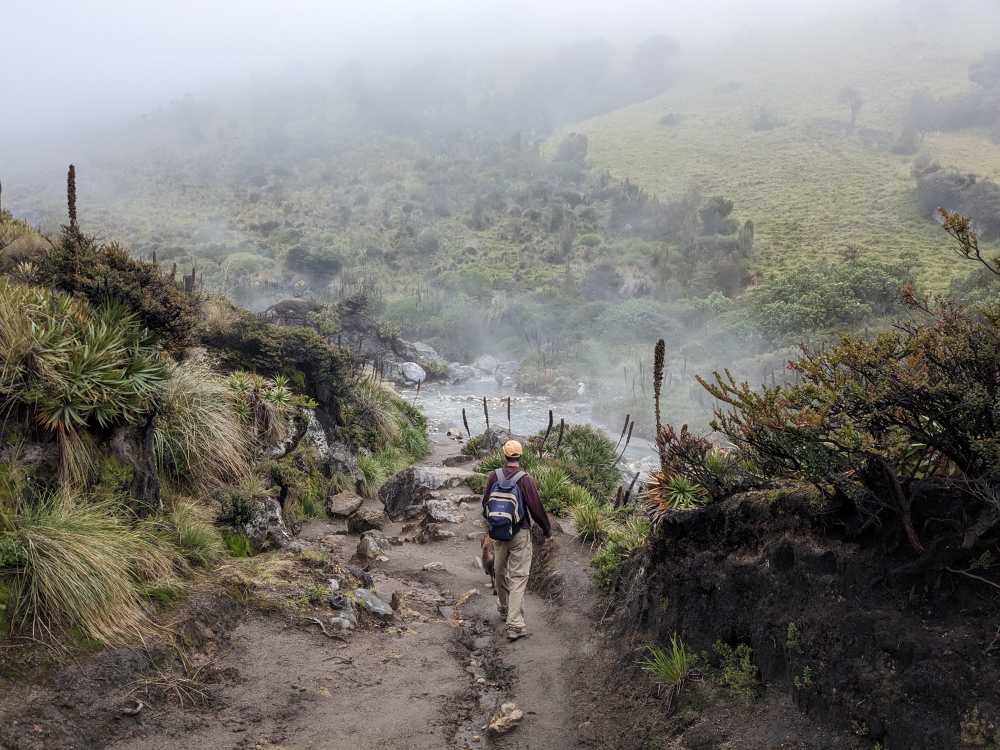
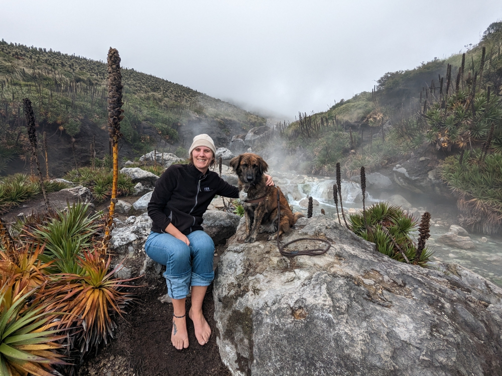
After our morning walk and breakfast, we drove to El Sifon hot springs. It wasn’t even 9am yet and the volcano was already covered by clouds, with fog starting to roll in. But the first few miles were still photogenic, with lots of waterfalls along the road.
We saw many waterfalls on our drive to the hot springs, even further up the mountain.
The weather was still nice this early, but the volcano was already shrouded by clouds.
Well above the tree line…
And then the clouds, mist, and rain arrived – for the rest of the day!
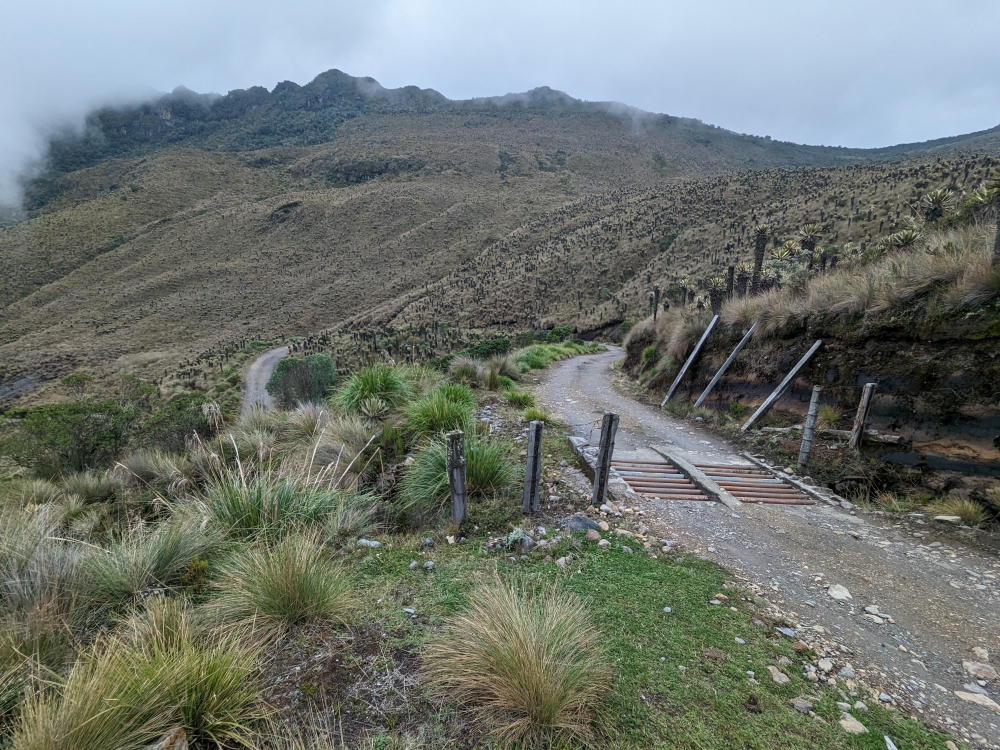
Parking area for the walk down to the hot springs
Where is the trail?
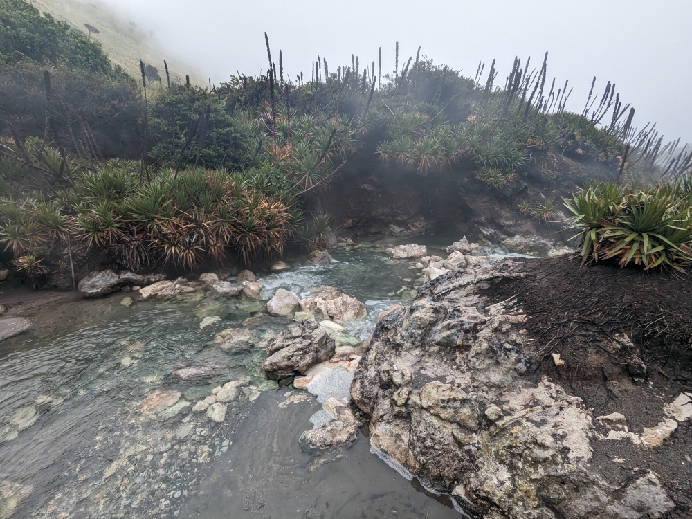
We managed to find a dirt road at some point and descended about 1,000ft towards the river and the natural hot springs.
We had the area to ourselves!
Hot river
It was a pity that the sun didn’t reach down here.
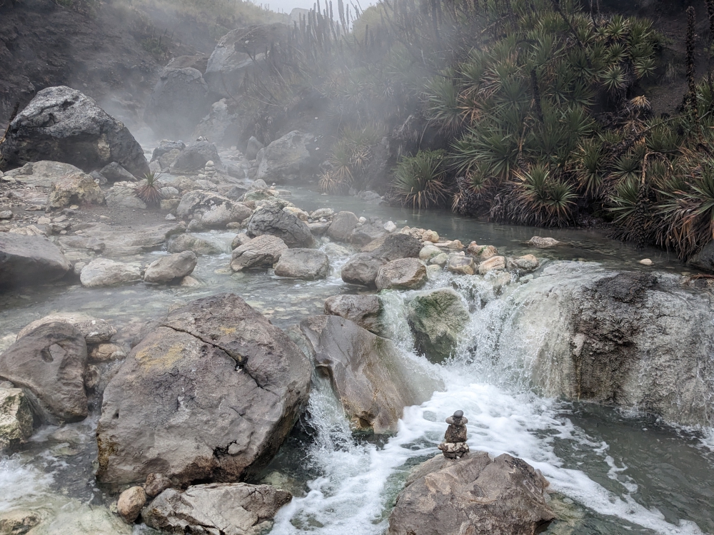
We scanned the steaming river for the best place to take a dip.
We found our spot: under the two waterfalls was a small pool.
This was a very scenic area, despite the steam.
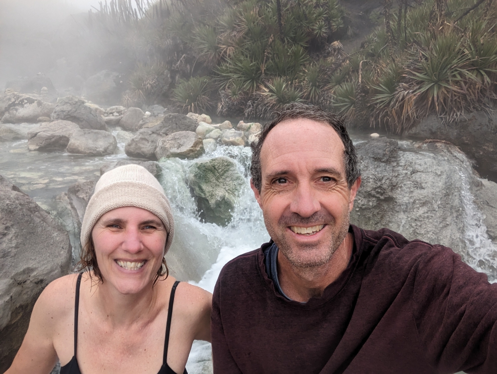
Maya was not allowed in the hot water (our rules).
Maya behaved well and patiently waited on dry ground.
After our soak – the contrast between the water and air temperature was huge!
One last shot of El Sifon hot springs!
Then, the walk back up was inevitable. It took forever, since the air was thin and we needed to stop often to catch our breath, especially me.
Back at the parking lot, life went on as always.
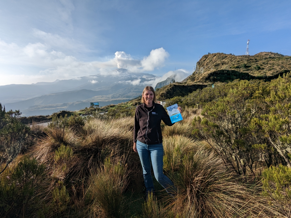
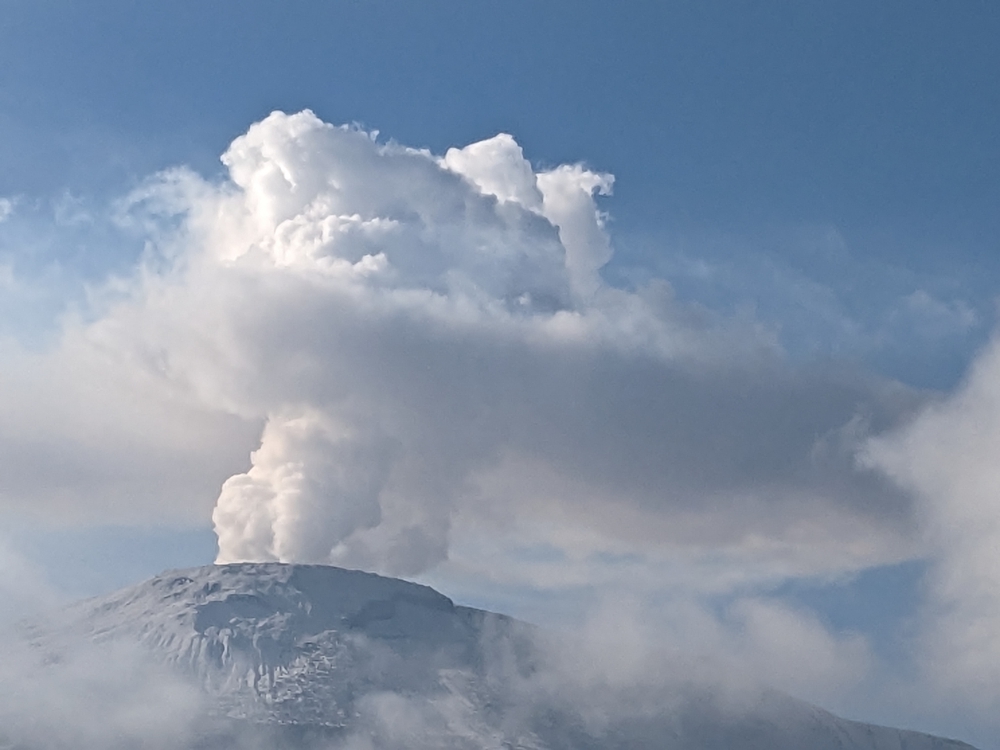
On our second morning, I encouraged Mark to take a photo of me and my book, Plunge, in front of the volcano…
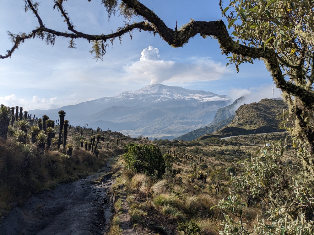
That’s when we noticed a slight change in the appearance of Nevado del Ruiz…
Most of the snow had melted and it was spewing steam!
The photos underneath were taken around the same time, early in the morning, two days in a row. Do you notice the difference in the volcano’s appearance?
Our camper looks tiny in this immense landscape.
Can you see the difference between the two moods of the volcano!
Mark took this fabulous shot.
Mark, Maya, and I came here in our truck camper Thirsty Bella to check out the hot springs and we received these spectacular views as a bonus! It was one of the quietest places we camped in Colombia. We did have to leave after two nights, though, because it was difficult to sleep and breathe at 13,000ft (4,000m) altitude and the condensation inside the camper was so bad that water kept dripping down from the ceiling!
(A week later, people from the surrounding villages had to be evacuated because of the heightened risk of a volcanic eruption and access to this area became restricted. Until now, nothing dangerous has happened. Read a CNN article here.)
360-degree view on our morning walks with Maya
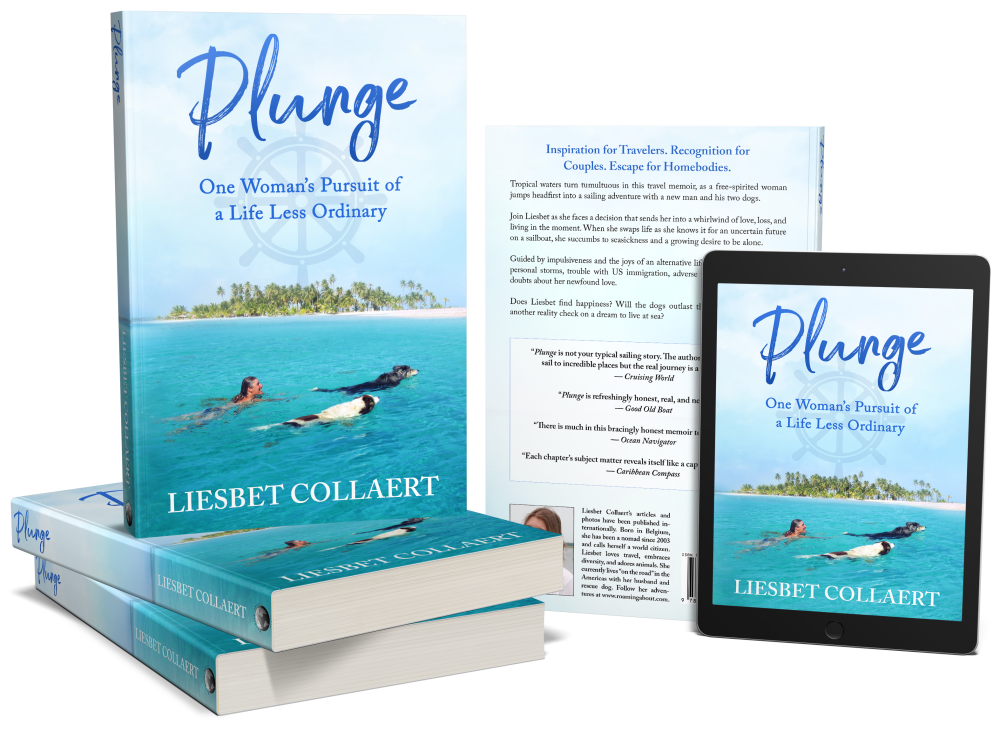
Curious about a previous ten-year chapter in our nomadic lives, which includes eight years aboard a 35-foot sailboat in the tropics with dogs, check out my compelling, inspiring, and refreshingly honest travel memoir:
Plunge – One Woman’s Pursuit of a Life Less Ordinary
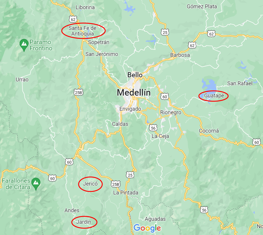
All three towns have been declared pueblos patrimonios in Colombia (because they stand out for their cultural heritage) and are worth a visit. Medellin is centrally located for attractive day or weekend trips to these destinations in the Department of Antioquia. Or, in our case, for continued travels to explore Colombia. A fourth highlight, Guatapé, sits two hours east and was part of my Medellin post. Santa Fe de Antioquia can be found an hour and a half to the northwest. You reach Jericó after a three-hour southward drive and Jardin is a tad further away, about 3.5 hours to the south.
Historic towns around Medellin
Santa Fe de Antioquia
As a former capital of Colombia and a national monument, Santa Fe de Antioquia is a popular place. It is a beautiful, eye-catching, and photogenic city of 23,000 inhabitants. But there is one problem. For us anyway. Its climate is tropical and humid, due to its low elevation in the Cauca River valley and proximity to the equator. It was in the mid-nineties when we arrived (35°C)!
Driving to Jardin
Scenery on the way to Jardin
Hot parking spot in Santa Fe de Antioquia
(As always hover over or click on photos in galleries to read their captions.)
Our first “meeting” with the town didn’t go well. Checking the map for the best route to a free overnight parking spot we had found in our free app iOverlander, we’d picked a one-way road towards our site, thinking it would be wide enough and less littered with haphazardly parked cars. We were right, but… the road went steep uphill and, without any indication, was blocked by road work! We couldn’t go around it. We couldn’t turn around. We couldn’t back up, down this steep and bumpy road without visibility. All the while, motorcycles kept passing us (they could go through) and lined-up cars behind us kept honking.
I enabled a neighbor’s help to open the locked gate of his driveway and guided Mark to safely turn around. We headed back the way we came and my husband was ready to abandon our planned visit. I persisted. We were all sweating (and panting), there was no shade anywhere, and options to camp were limited. On foot, I checked out a parqueadero (parking lot) that abutted the historic center. Big buses and trucks were parked there, so we would fit. We just needed to navigate one more narrow road. Mark obliged and we hid inside our camper, fans on full speed, for the rest of the afternoon.
Night scene
Lit-up historic buildings
Cute courtyard
Door at night
Well taken care of buildings in town
Church on the main plaza
When the temperature dropped slightly and darkness set in, the three of us quickly walked through the center of town. Unfortunately, the moods didn’t improve. Being kept awake all night by arriving and departing buses, garbage trucks, and dump trucks didn’t help the situation by morning. Mark had had it with this place, so I ventured back into the historic part early and for just one hour. Then, we moved on. Did I mention it was Mark’s birthday?
Nun walking the streets – my artist friend Laurie made a painting of this photogenic scene
After enjoying Villa de Leyva, the end of January, the plan was to embark on another off-the-beaten-track adventure. But, as we wrapped up an extended stay in our favorite Colombian pueblo patrimonio, we faced two possible issues: the weather forecast predicted rain which could make the dirt roads impassable and we were on a deadline, because we wanted to visit our friends Susan and John in El Retiro for a handful of days, before they’d leave on a trip in the middle of February and would have other guests prior to that. Plus, we were in the midst of dealing with a vehicle extension and didn’t know if this would require a last-minute stop in Medellin.
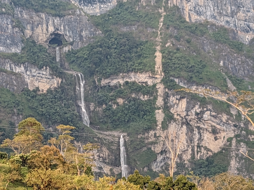
Tiered waterfalls in Florián
Could we fit in a multiple-day side trip to Florián without encountering muddy roads, would the challenging detour be worthwhile, and would we have enough time left to make the two-day drive and visit Rio Claro on the way to El Retiro?
Map Colombia
Florián in Santander, Colombia
Few Colombians have heard of Florián, located in the middle of the mountains of the Santander department. Wikipedia in English doesn’t have much info but the Spanish page has a bit more data. The town is known for its multi-tiered waterfall, which tumbles out of a cave. It sounded cool but would take us a full day to reach; the last four hours over bouncy, slow, dirt roads.
(As always, hover over or click on photos in galleries to read their captions.)
Mountain road
Pretty views along the drive into the mountains
Rocky road surfaces
A busy stretch – if that car can drive here, we can!
Narrow, one-lane roads to reach our destination
Leaving Florián the same way we came
Mark stumbled across this destination a few months ago, probably seeing photos by a fellow overlander on Facebook. He pinned it in Google maps, which is how we now compile lists of worthwhile destinations. And, by reading in our fat South America Lonely Planet.
When we arrived, exhausted and shaken, we parked along the main square for the night. We walked around town and to a viewpoint of the valley, wondering where the waterfall was located. We surely thought we’d have seen – if not heard – it by now. That’s when we discovered there was nothing but a trickle, none of it visible from a distance. To say we were disappointment is an understatement!
The negative about writing these blog posts three months after the facts means that I don’t remember all the details. Like when I’m behind with my diary for a few days – which often happens. A positive – in case of the diaries anyway – is that I don’t remember all the details. So, instead of an hour, such an entry takes half an hour to write. 😊
Pretty mountain drive
All this being said, I remember Mark and I wanted to do something different after leaving the sinkholes of Las Gachas: driving to the municipality of Paipa across the mountains, via dirt roads. Why is this such a big deal? Because there is no information available about secondary, or tertiary, routes in Colombia.
(As always, hover over or click on photos in galleries to read their captions.)
One-lane roads
New road after a landslide
Ooops. We got too close to the berm when passing another vehicle
A lot of rain falls in this country, causing landslides every day. Our thoroughfare might be blocked by fallen trees, piles of dirt, rocks, or other objects. Or, the road might be gone, crumbled down a cliff. In other cases, the streets might be too narrow or low due to overhanging trees. Our truck camperThirsty Bella is big. In Colombia it’s not an issue of “When will we get there,” like in other countries, but “Will we be able to get there or do we have to turn around hours into the voyage?” Such is the kind of adventures we embark on these months.
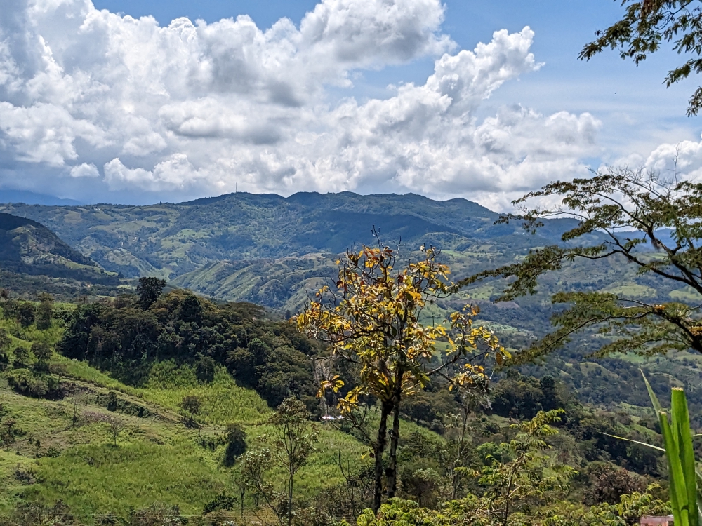
Sightseeing in the mountains
Dirt road through the mountains
Scenery along the way
Dominating the mountain roads
Small waterfall along the road
After quickly visiting Guadalupe, filling our fuel tank, backtracking over the narrow, potholed road to the main “highway,” following that south for a couple of hours, and turning off for the rough “shortcut,” we reached Gambita. We descended into this small town, still in the department of Santander, after asking locals if our rig could navigate the narrow streets. It could. Barely.
We have been perpetual nomads since 2003 – sailing, camping, RVing, house and pet sitting – and are currently roaming about South America in a truck camper with our rescue dog, Maya. As lifetime adventurers, we are self-employed and maintain a tight budget. This blog is about all that – and more – to inspire a life less ordinary. Don’t dream but do! 🙂